Cicada Safari
2.9star
209 reviews
50K+
Downloads

Everyone
info


About this app
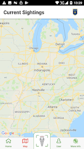
People have been recording periodical cicada emergences for nearly four centuries. These maps have been critical in verifying the cicadas’ long life cycles and the relationships of the broods to each other.
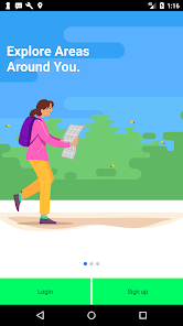
Help us map the 2021 emergence with Cicada Safari! Your submitted photos will be used to determine the range of Brood X.
Help us map the 2021 emergence with Cicada Safari! Your submitted photos will be used to determine the range of Brood X.
Updated on
Safety starts with understanding how developers collect and share your data. Data privacy and security practices may vary based on your use, region and age The developer provided this information and may update it over time.


Ratings and reviews
2.8
196 reviews

A Google user
- Flag inappropriate
- Show review history
5 June 2019
App is a bit clunky but they're working on it (it's a research project and I applaud the effort). App developer is responsive to emails. One potential improvement would be to use EXIF data or photo geotags to place images on the map. Right now it appears they post where uploaded, not where captured. Another idea might be use a heatmap to display sighting frequency and overlay markers at a closer zoom level.
52 people found this review helpful
Mount St. Joseph University
12 June 2019
Hi Thomas! Thank you for the feedback. This issue should be fixed in the latest version. The location will now be based on where the image was taken. Thank you for reaching out!

Nicholas Gimbrone (Nick)
- Flag inappropriate
- Show review history
28 May 2021
Crowd sourced research for science matters, making this a great app... that said, as an app it is less then sterling. The most glaring "missing" or "broken" aspects are: (1) that the notifications are useless, no ability to click one to see which image it is talking about and that the number of them seems unrelated to reality (I get hundreds more than I have pictures taken); (2) an "delay uploads of reports until next connected to wifi"; (3) that videos seem to never be accepted or rejected; (4) that jpg files are stored in DCIM rather than a subfolder; (5) I so far have not figured out where videos are stored, seems like with Camera they should be in the same location as the jpg files.
31 people found this review helpful

Katie D
- Flag inappropriate
4 June 2021
I was pretty excited to see sightings popping up in my area so I went out looking. Read all the instructions about how to take photos and videos. The directions weren't super clear, but I figured it out. Rather than use my cell data to take photos in the app I took pics and then planned to upload them at home. Sadly, nothing will upload because it says there is no geotag. This was not in the instructions and there is definitely a geotag attached. So...big bummer for me.
25 people found this review helpful
What's new
- Minor Improvements


