Országos Kéktúra
50K+
Downloads

Everyone
info


About this app
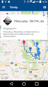
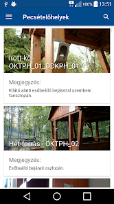
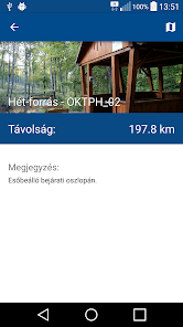
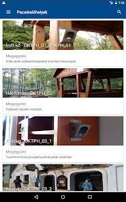
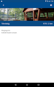
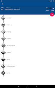
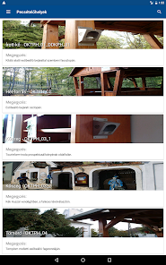
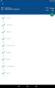
An application to the hikers. OCT helps you find the seal sites. It also features a spotting points descriptions, photos, address and GPS coordinates. It calculates the distance between the sealing area and the current situation, and the difference in level also provides an opportunity to consider the selected location spotting and hiking trails map.
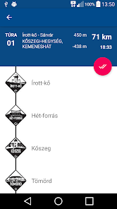
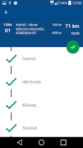
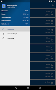
We may record that has been achieved our hiking trails, and which are the ones that are yet to come. From these data and statistics on, so we keep track of how many have completed our hike percent, and much remains to be done.
The whole development have created on their own. The app is free and ad-free. The user does not bear any cost, but welcome it, if you have typed a like-kot my site Facebook: https://goo.gl/PWfcF8
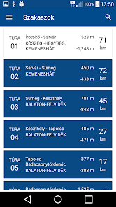
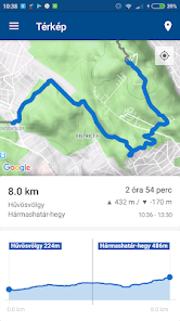
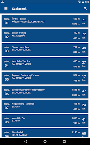
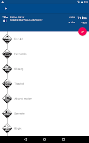
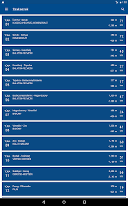
The National Blue Tour Hungary's most popular hiking trails. Length of 1160 km, which is broken down into 27 sections. During the entire route should go through the performance and stamped 149 (+3 booklet published since the release) seal the supporting points in booklet.
We may record that has been achieved our hiking trails, and which are the ones that are yet to come. From these data and statistics on, so we keep track of how many have completed our hike percent, and much remains to be done.
The whole development have created on their own. The app is free and ad-free. The user does not bear any cost, but welcome it, if you have typed a like-kot my site Facebook: https://goo.gl/PWfcF8
The National Blue Tour Hungary's most popular hiking trails. Length of 1160 km, which is broken down into 27 sections. During the entire route should go through the performance and stamped 149 (+3 booklet published since the release) seal the supporting points in booklet.
Updated on
Safety starts with understanding how developers collect and share your data. Data privacy and security practices may vary based on your use, region and age The developer provided this information and may update it over time.

No data shared with third parties
Learn more about how developers declare sharing

No data collected
Learn more about how developers declare collection

Data is encrypted in transit

Data can’t be deleted
What's new
Az alkalmazással könnyebben rátalálhatsz a kéktúra pecsétekre. Nyilvántarthatod mely szakaszokat teljesítetted, illetve mik hiányoznak még. Segít a túrák megtervezésben, és térképen mutatja a legfrissebb kéktúra útvonalat. Már használható nem csak az Országos Kéktúra, de az Alföldi és Dél Dunántúli kéktúrára egyaránt.
v2.0.2:
Hiba javítások. Apróbb frissítések.
v2.0.2:
Hiba javítások. Apróbb frissítések.