
C7 GPS Dados
3.9star
1.84K reviews
100K+
Downloads

Everyone
info
About this app
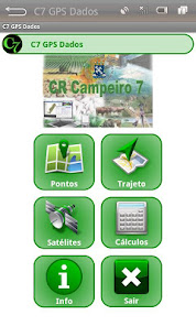
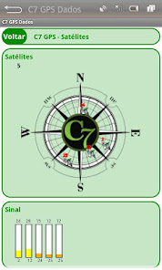
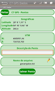
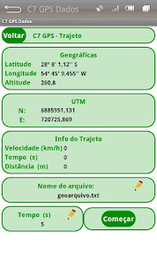
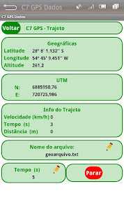
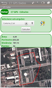
The C7 GPS Application Data aims to obtain coordinates of individual points (waypoints) or tracks, allowing the storage of the same file on a GeoTXT. This system is a simplification of the C7 GPS mesh whose modeling is focused on the application of Precision Agriculture, however features a new graphic design, enables the graphical display of the constellation of satellites tracked and the received signal strength of each. The coordinates of the current position are displayed in decimal degrees geographic, hexagesimais and also in UTM projection. With the data stored in files can be processed calculations of area and perimeter of polygons and the total distance traveled on a track recorded.
Updated on
Safety starts with understanding how developers collect and share your data. Data privacy and security practices may vary based on your use, region, and age. The developer provided this information and may update it over time.

No data shared with third parties
Learn more about how developers declare sharing

No data collected
Learn more about how developers declare collection
Ratings and reviews
3.9
1.82K reviews

Oscar Rojas
- Flag inappropriate
January 17, 2025
By clicking on ponts the app crashes and closes automatically

Pita Massossote
- Flag inappropriate
May 14, 2022
Useful

A Google user
- Flag inappropriate
February 23, 2020
Beutiful people
4 people found this review helpful
What’s new
Android 10 and 11
App support
About the developer
ENIO GIOTTO
crcampeiro@gmail.com
Brazil
undefined