
Control Tower
100+
Downloads

Everyone
info


About this app
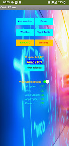
Always carry with you a flight controller who is always ready to give you all the information you need.
- Consult the aeronautical maps from all over the world, updated to the most recent Airac cycle for
know the information for a safe flight
- Create your flight plan via the leading Garmin FltPlan service
in flight planning
- Fly with your drone always staying up to date on the main regulations
of the world (FAA, EASA)
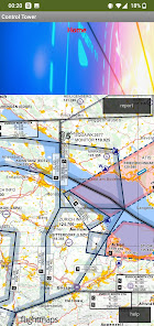
- The flight zones for your drone updated in real time by AirMap and with the
latest weather information via UAV Forecast
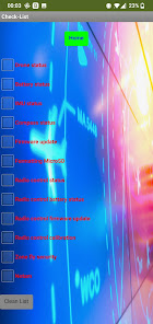
- Fill out the pre-flight checklist to keep your drone always operational
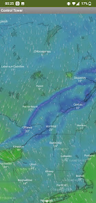
- Check the weather with rich information on punctual forecasts and
precise by Windy
- Live air traffic from FlightRadar 24
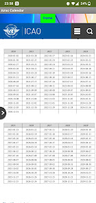
- Notams and Metar services constantly updated
- Decode Metars for easier reading
- Hear conversions between the control towers of the world's major airports and
aircraft
Downloadable aeronautical maps:
Belgium (EB), Germany (ED), Finland (EF), Netherlands (EH), Denmark (EK), Poland (EP), Sweden (ES), South Africa (FA), Namibia (FY), Bulgaria (LB) , Croatia (LD), Greece (LG), Hungary (LH), Italy (LI), Slovenia (LJ), Czech Republic (LK), Malta (LM), Austria (LO), Romania (LR), Switzerland (LS ), Slovakia (LZ).
- Consult the aeronautical maps from all over the world, updated to the most recent Airac cycle for
know the information for a safe flight
- Create your flight plan via the leading Garmin FltPlan service
in flight planning
- Fly with your drone always staying up to date on the main regulations
of the world (FAA, EASA)
- The flight zones for your drone updated in real time by AirMap and with the
latest weather information via UAV Forecast
- Fill out the pre-flight checklist to keep your drone always operational
- Check the weather with rich information on punctual forecasts and
precise by Windy
- Live air traffic from FlightRadar 24
- Notams and Metar services constantly updated
- Decode Metars for easier reading
- Hear conversions between the control towers of the world's major airports and
aircraft
Downloadable aeronautical maps:
Belgium (EB), Germany (ED), Finland (EF), Netherlands (EH), Denmark (EK), Poland (EP), Sweden (ES), South Africa (FA), Namibia (FY), Bulgaria (LB) , Croatia (LD), Greece (LG), Hungary (LH), Italy (LI), Slovenia (LJ), Czech Republic (LK), Malta (LM), Austria (LO), Romania (LR), Switzerland (LS ), Slovakia (LZ).
Updated on
Safety starts with understanding how developers collect and share your data. Data privacy and security practices may vary based on your use, region and age The developer provided this information and may update it over time.

No data shared with third parties
Learn more about how developers declare sharing

No data collected
Learn more about how developers declare collection
App support
phone
Phone number
+393404178668
About the developer
Francesco Sica
franks90k@gmail.com
Via Ormadelli, 27
25081 Bedizzole
Italy
undefined

