
TKGM Parsel Sorgu
3.8star
13.5K reviews
5M+
Downloads

Everyone
info

About this app
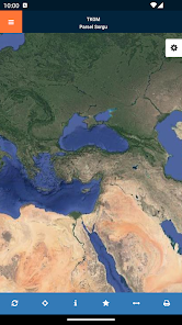
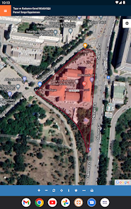
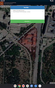
According to various queries by the plots in Turkey
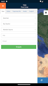
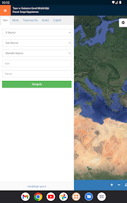
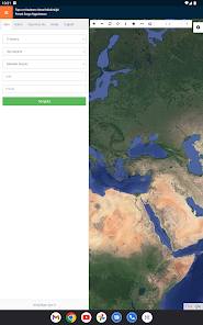
• Administrative Query (City, County, District, Ada Plot in hierarchy)
• Address Query (inquiry based on the entered address)
• coordinate query (query according to the entered coordinate values)
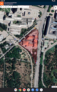
• Map out inquiry (inquiry based on the selected map coordinates)
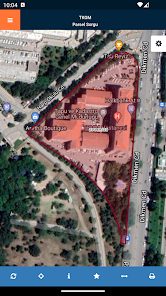
querying and located parcels
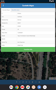
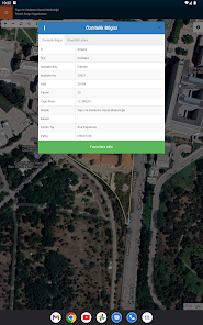
• The attribute information
that province, county, district, island and parcel information
My information is that Yüzlöç
he Sheet information
that the district information
Qualities that information
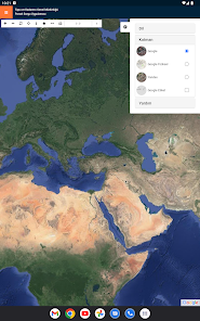
• Geographical Information
o Coordinate information
Display is provided.
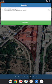
through the application of coordinates and information in parcels
it Pdf
he Kml
o Geo Json
It is provided to be downloaded
Found route to the parcel service providers (Google map, map Bing, Yandex Map, etc.) are provided with routing done
Information
- Spatial Property System (MEGSIS) and the harmonization of land registry and cadastre information studies and checks are carried out by our organization.
- This application and data are provided to be aligned with MEGSİS deed under basic information of the completed cadastral information.
- If there is a mismatch between land related information with the records displayed in your hands and / or be referred to the cadastral office.
- immovable position information of the test object are presented with approximate coordinates.
- THIS INFORMATION PROVIDED IN PRACTICE AND COMMERCIAL PROPERTY USED FOR OFFICIAL ...
• Administrative Query (City, County, District, Ada Plot in hierarchy)
• Address Query (inquiry based on the entered address)
• coordinate query (query according to the entered coordinate values)
• Map out inquiry (inquiry based on the selected map coordinates)
querying and located parcels
• The attribute information
that province, county, district, island and parcel information
My information is that Yüzlöç
he Sheet information
that the district information
Qualities that information
• Geographical Information
o Coordinate information
Display is provided.
through the application of coordinates and information in parcels
it Pdf
he Kml
o Geo Json
It is provided to be downloaded
Found route to the parcel service providers (Google map, map Bing, Yandex Map, etc.) are provided with routing done
Information
- Spatial Property System (MEGSIS) and the harmonization of land registry and cadastre information studies and checks are carried out by our organization.
- This application and data are provided to be aligned with MEGSİS deed under basic information of the completed cadastral information.
- If there is a mismatch between land related information with the records displayed in your hands and / or be referred to the cadastral office.
- immovable position information of the test object are presented with approximate coordinates.
- THIS INFORMATION PROVIDED IN PRACTICE AND COMMERCIAL PROPERTY USED FOR OFFICIAL ...
Updated on
Safety starts with understanding how developers collect and share your data. Data privacy and security practices may vary based on your use, region and age The developer provided this information and may update it over time.

No data shared with third parties
Learn more about how developers declare sharing

No data collected
Learn more about how developers declare collection
Ratings and reviews
3.8
13.2K reviews

Yaagoub AlNujaidi
- Flag inappropriate
25 August 2020
Excellent App...but wish it gives you the option to copy the Map Location Coordinates to be saved or used in Google Maps outside the App, or send to someone. Sharing is not supported, to send the location to a friend via Whatsapp or other programs such as email.
6 people found this review helpful

Simon C
- Flag inappropriate
02 March 2022
Excellent app for local use. Recommended especially if looking to buy land or property.
1 person found this review helpful

Khurram Kamaal
- Flag inappropriate
09 January 2022
I can't open this application, getting response " error occurred ".
2 people found this review helpful
What's new
Taşınmaz No sorgulama kaldırıldı
App support
phone
Phone number
+903125514118