
Bayern in historischen Karten
4.6star
233 reviews
10K+
Downloads

Everyone
info


About this app
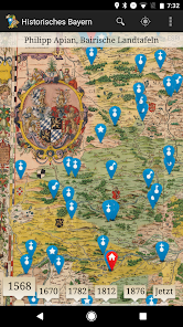
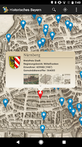
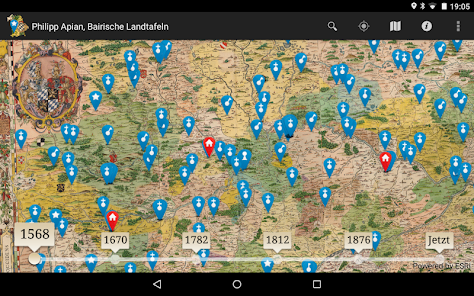
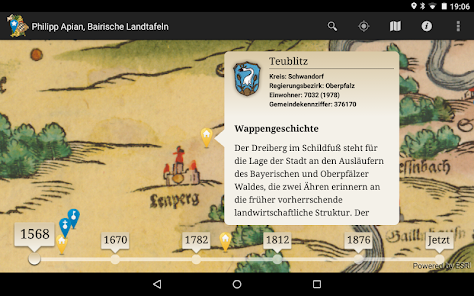
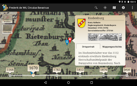
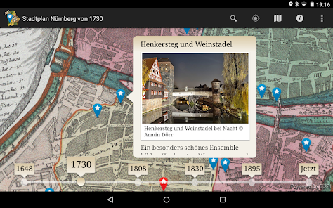
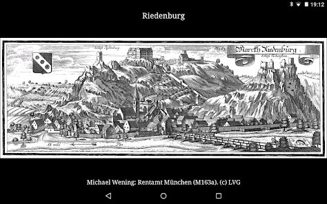
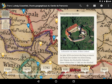
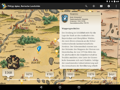
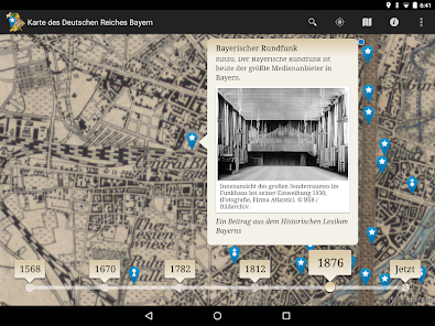
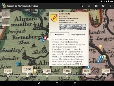
The location-based services app "Bayern in historical maps" takes you on a fascinating journey to discover Bavaria cities, towns and historic monuments. Unique and rare historical maps of Bavaria owned by the Bavarian State Library, the State records Apian (1568) to the "Topographic Atlas of kingdoms Bavaria" (1812-1867), can be viewed in detail and interactively explored. Your current position as observer is shown directly in the historical map, a timeline, you can seamlessly navigate between the different map series. Diverse points-of-interest offer in-depth representations to places, castles, abbeys and castles in the vicinity of your location, including 1,000 historic local views of Wening, Merian and Schedel. As a special highlight of the Nuremberg-focus offers a variety of multimedia information around the Imperial Castle City.
The Bavarian State Library is one of the world's largest and most important universal libraries. To their holdings are world famous and valuable works of the written cultural heritage of mankind, including a comprehensive collection of historical maps. The app "Bayern in historical maps" is a service of the Bavarian State Library on the go and at home. On site you will see your current position in the selected historical map, as well as interesting places and sites near them. Home you can go to the high-resolution digitized historical maps on a virtual discovery tour through Bavaria. The offer is constantly expanding with new content.
The Bavarian State Library is one of the world's largest and most important universal libraries. To their holdings are world famous and valuable works of the written cultural heritage of mankind, including a comprehensive collection of historical maps. The app "Bayern in historical maps" is a service of the Bavarian State Library on the go and at home. On site you will see your current position in the selected historical map, as well as interesting places and sites near them. Home you can go to the high-resolution digitized historical maps on a virtual discovery tour through Bavaria. The offer is constantly expanding with new content.
Updated on
Safety starts with understanding how developers collect and share your data. Data privacy and security practices may vary based on your use, region and age The developer provided this information and may update it over time.

No data shared with third parties
Learn more about how developers declare sharing

No data collected
Learn more about how developers declare collection

Data is encrypted in transit

Data can’t be deleted
Ratings and reviews
4.6
192 reviews

A Google user
- Flag inappropriate
21 November 2014
Great application! Would you consider an English version to make it available to a greater audience? It'd be perfect for history lovers like myself.
6 people found this review helpful
What's new
- kleine Fehlerkorrekturen