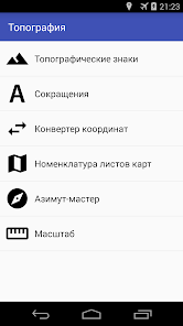
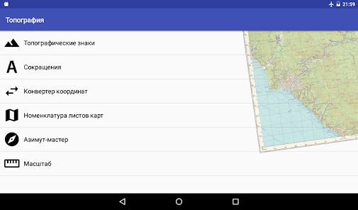
Топография
Contains ads
100K+
Downloads

Everyone
info


About this app
Directory and tools for working with topographic maps.
The application comprises:
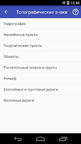
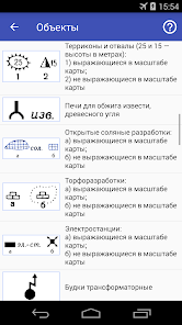
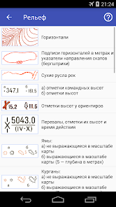
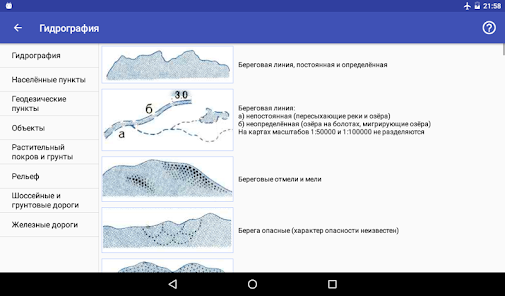
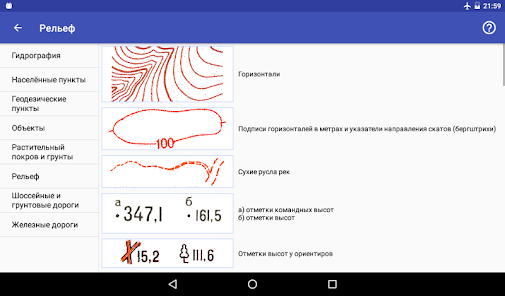
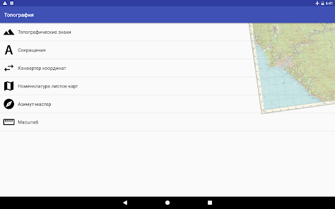
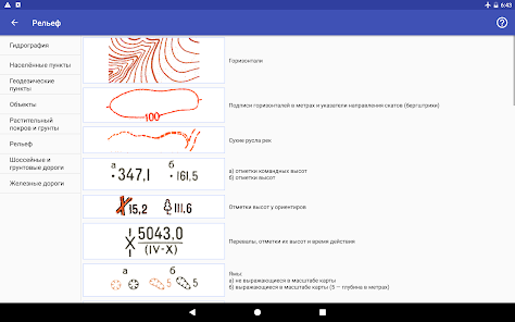
- Symbols of Russia and the Soviet Union topographic maps;
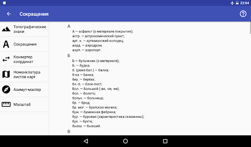
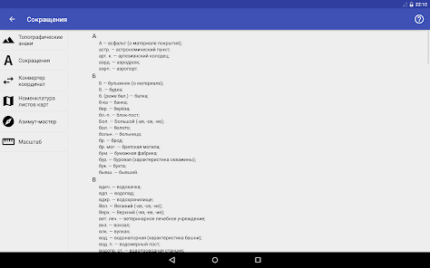
- Alphabetical list of abbreviations and acronyms found on topographic maps;
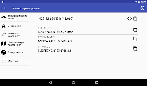
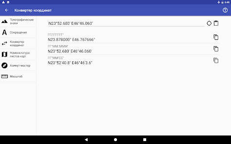
- coordinate converter that allows you to convert geographic coordinates from different formats to the formats most commonly used in navigation tools, applications and online services;
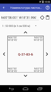
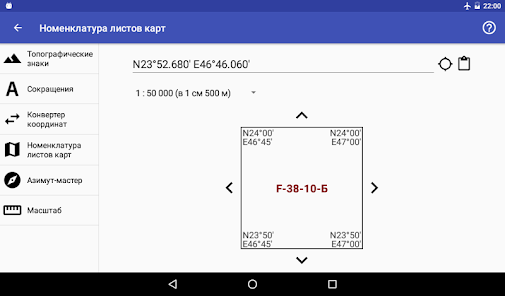
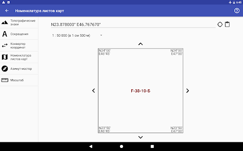
- Caller topographic map sheet in razgrafki system and nomenclature of topographic maps the coordinates point of interest;
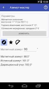
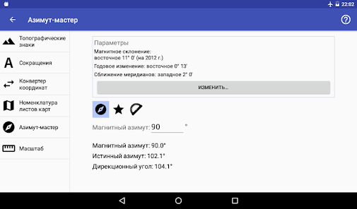
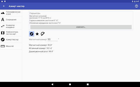
- Calculation of the magnetic azimuth of the true azimuth and azimuth angle;
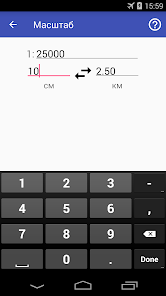
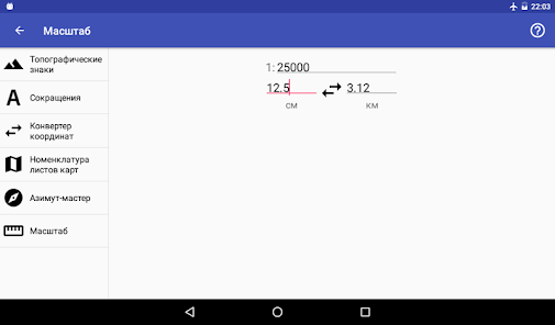
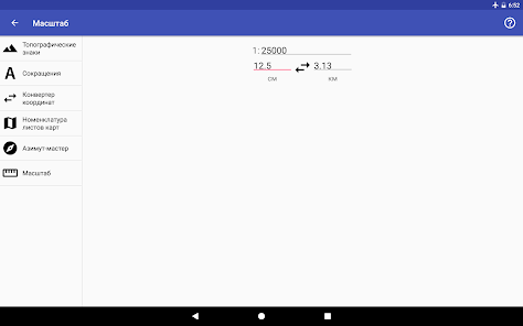
- Translation of the distances measured on the map (see below), in real terms (km) and vice versa.
The application comprises:
- Symbols of Russia and the Soviet Union topographic maps;
- Alphabetical list of abbreviations and acronyms found on topographic maps;
- coordinate converter that allows you to convert geographic coordinates from different formats to the formats most commonly used in navigation tools, applications and online services;
- Caller topographic map sheet in razgrafki system and nomenclature of topographic maps the coordinates point of interest;
- Calculation of the magnetic azimuth of the true azimuth and azimuth angle;
- Translation of the distances measured on the map (see below), in real terms (km) and vice versa.
Updated on
Safety starts with understanding how developers collect and share your data. Data privacy and security practices may vary based on your use, region and age The developer provided this information and may update it over time.

No data shared with third parties
Learn more about how developers declare sharing

No data collected
Learn more about how developers declare collection
What's new
Добавлен алфавитный перечень русскоязычных сокращений и аббревиатур, встречающихся на топографических картах.


