
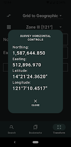
Survey Horizontal Controls
500+
Downloads

Jedes Alter
info
Über diese App
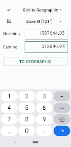
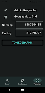
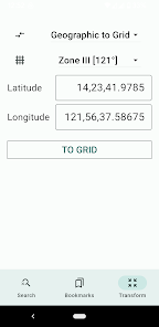
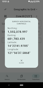
A database of commonly used Philippine survey reference points, grouped by region. This app is useful for geodetic engineers, cartographers, CAD users, and real property consolidators who need to plot parcels of land in the correct projection (LPCS, Grid, or PRS'92).
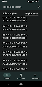
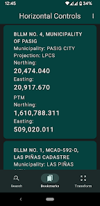
Search for the correct Northings and Eastings (y and x coordinates) of BLLMs, MBMs, BBMs, cadastral reference monuments, and more. Simply tap the magnifying glass icon, select the region where the reference point is located, and enter the monument number and survey/cadastral number to find it.
(Note for rooted Android device users: This app will not run on rooted device.)
Aktualisiert am
Was die Sicherheit angeht, solltest du als Erstes verstehen, wie Entwickler deine Daten erheben und weitergeben. Die Datenschutz- und Sicherheitspraktiken können je nach deiner Verwendung, deiner Region und deinem Alter variieren. Diese Informationen wurden vom Entwickler zur Verfügung gestellt und können jederzeit von ihm geändert werden.

Keine Daten werden mit Drittunternehmen oder -organisationen geteilt

Keine Daten erhoben
Support für diese App
Informationen zum Entwickler
Edgardo Adarlo
eadarlo0215@gmail.com
7765 Unit B Sampaguita Compound
Carsadang Bago II, Imus
4103
Philippines
undefined