Natural Disaster Monitor
Enthält Werbung
3.3star
303 Rezensionen
50 Tsg.+
Downloads

Jedes Alter
info


Über diese App
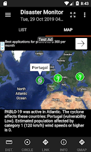
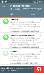
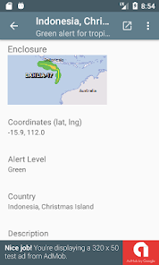
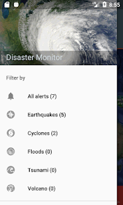
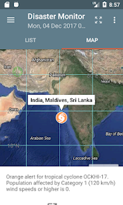
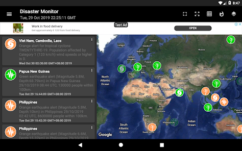
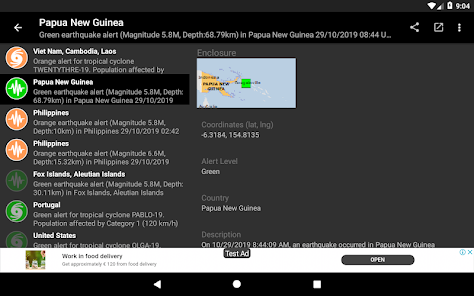
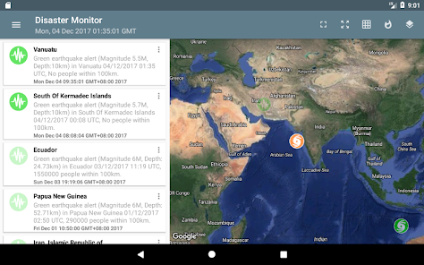
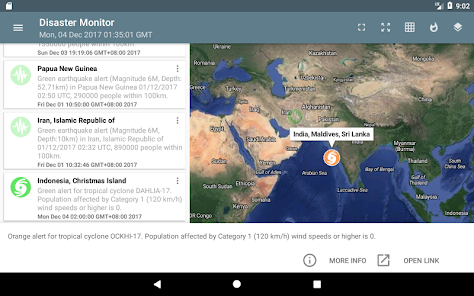
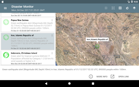
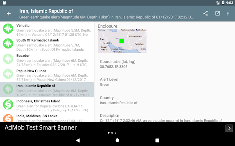
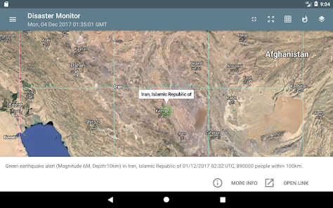
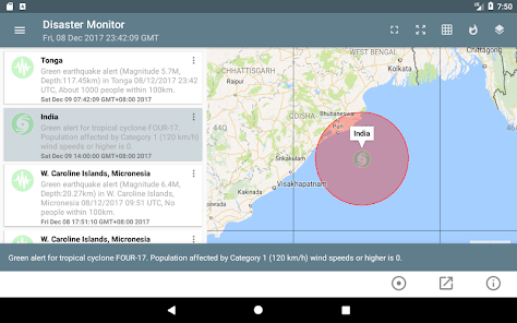
You can monitor natural disasters around the world, as published by the Global Disaster Alert and Coordination System - www.gdacs.org. The app shows the latest natural disasters like earthquakes, droughts, volcano eruptions, tropical cyclones, tsunamis and floods as color coded icons in a list as well as on a Google Maps backdrop; the icon colors indicate the alert level - green, orange, and red. The icon will look more transparent the older the event was published. Clicking on the item will bring up more details about the disaster event. UTM or geographic grids can optionally be displayed on the map.
* Now with dark mode setting.
* Now with dark mode setting.
Aktualisiert am
Was die Sicherheit angeht, solltest du als Erstes verstehen, wie Entwickler deine Daten erheben und weitergeben. Die Datenschutz- und Sicherheitspraktiken können je nach deiner Verwendung, deiner Region und deinem Alter variieren. Diese Informationen wurden vom Entwickler zur Verfügung gestellt und können jederzeit von ihm geändert werden.

Keine Daten werden mit Drittunternehmen oder -organisationen geteilt

Keine Daten erhoben

Daten werden bei der Übertragung verschlüsselt

Daten können nicht gelöscht werden
Bewertungen und Rezensionen
3.3
253 Rezensionen
Neuigkeiten
Upgrade to Android API 34.
Upgrade to Maps Sdk 18.2.0.
Fix feed not downloading.
Upgrade to Maps Sdk 18.2.0.
Fix feed not downloading.


