London TFL Tracker
In-App-Käufe
5 Tsg.+
Downloads

Jedes Alter
info


Über diese App
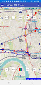
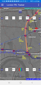
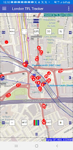
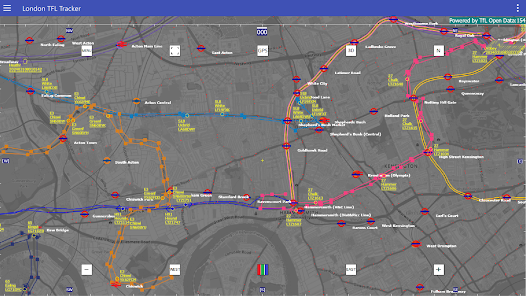
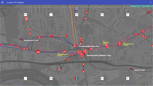
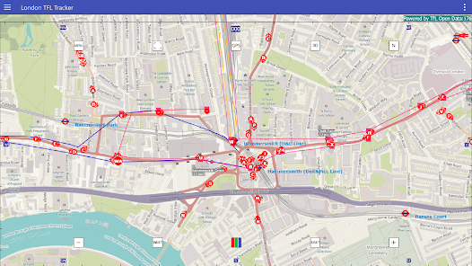
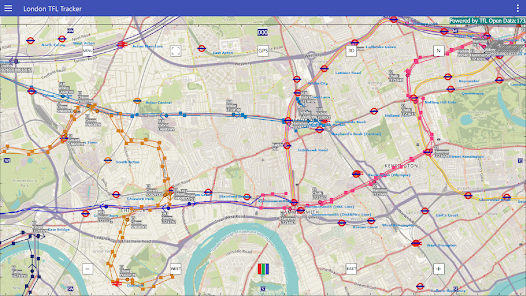
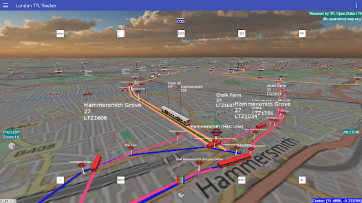
This app uses publicly available TFL REST API and attempts to use the information to render approximate position of buses and trains around you in the capital city of UK, London, on a custom rendered map sourced from Open Street Map.
That way you can see roughly how public transport is distributed around the city as well as around your current GPS position as reported by your mobile device.
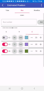
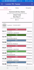
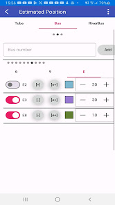
The app also provides users functionality to simply click on a bus or trains top to see the arrival times to that stop point.
This project is still in development and has a few bugs that are being ironed out.
Disclaimer:
THIS SOFTWARE IS PROVIDED `AS IS' AND ANY EXPRESS OR IMPLIED WARRANTIES, INCLUDING, BUT NOT LIMITED TO, THE IMPLIED WARRANTIES OF MERCHANT ABILITY AND FITNESS FOR A PARTICULAR PURPOSE ARE DISCLAIMED. IN NO EVENT SHALL THE AUTHORS AND/OR CONTRIBUTORS BE LIABLE FOR ANY DIRECT, INDIRECT, INCIDENTAL, SPECIAL, EXEMPLARY, OR CONSEQUENTIAL DAMAGES (INCLUDING, BUT NOT LIMITED TO, LOSS OF USE, DATA, OR PROFITS; OR BUSINESS INTERRUPTION) HOWEVER CAUSED AND ON ANY THEORY OF LIABILITY, WHETHER IN CONTRACT, STRICT LIABILITY, OR TORT (INCLUDING NEGLIGENCE OR OTHERWISE) ARISING IN ANYWAY OUT OF THE USE OF THIS SOFTWARE, EVEN IF ADVISED OF THE POSSIBILITY OF SUCH DAMAGE.
In simple terms; use this software at your own risk.
That way you can see roughly how public transport is distributed around the city as well as around your current GPS position as reported by your mobile device.
The app also provides users functionality to simply click on a bus or trains top to see the arrival times to that stop point.
This project is still in development and has a few bugs that are being ironed out.
Disclaimer:
THIS SOFTWARE IS PROVIDED `AS IS' AND ANY EXPRESS OR IMPLIED WARRANTIES, INCLUDING, BUT NOT LIMITED TO, THE IMPLIED WARRANTIES OF MERCHANT ABILITY AND FITNESS FOR A PARTICULAR PURPOSE ARE DISCLAIMED. IN NO EVENT SHALL THE AUTHORS AND/OR CONTRIBUTORS BE LIABLE FOR ANY DIRECT, INDIRECT, INCIDENTAL, SPECIAL, EXEMPLARY, OR CONSEQUENTIAL DAMAGES (INCLUDING, BUT NOT LIMITED TO, LOSS OF USE, DATA, OR PROFITS; OR BUSINESS INTERRUPTION) HOWEVER CAUSED AND ON ANY THEORY OF LIABILITY, WHETHER IN CONTRACT, STRICT LIABILITY, OR TORT (INCLUDING NEGLIGENCE OR OTHERWISE) ARISING IN ANYWAY OUT OF THE USE OF THIS SOFTWARE, EVEN IF ADVISED OF THE POSSIBILITY OF SUCH DAMAGE.
In simple terms; use this software at your own risk.
Aktualisiert am
Was die Sicherheit angeht, solltest du als Erstes verstehen, wie Entwickler deine Daten erheben und weitergeben. Die Datenschutz- und Sicherheitspraktiken können je nach deiner Verwendung, deiner Region und deinem Alter variieren. Diese Informationen wurden vom Entwickler zur Verfügung gestellt und können jederzeit von ihm geändert werden.

Keine Daten werden mit Drittunternehmen oder -organisationen geteilt

Keine Daten erhoben
Neuerungen
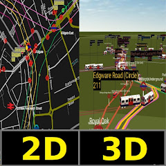
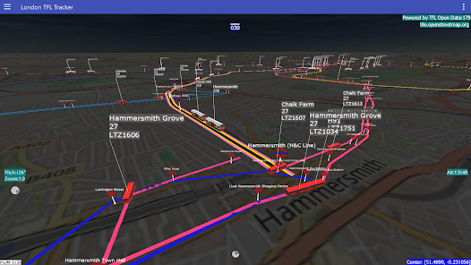
3D View
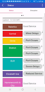
National Rail Arrivals
Buses/Trains moving step by step along their route (positions are approximate).
Open Street Map (OSM)
Approximate train/bus position tracking in real time
Click on Bus/Train stop to see arrival information
Proximity Warning on a bus/train within range.
GPS real time gives current speed and direction
Support für diese App
Informationen zum Entwickler
Mohamed Jebara
adsbflighttracker@gmail.com
38 Sterling Place
Ealing
LONDON
W5 4RA
United Kingdom


