
SMASH - Digital Field Mapping
1 Tsg.+
Downloads

Jedes Alter
info
Über diese App
SMASH is a digital field mapping application developed to perform fast qualitative engineering/geologic surveys and GIS data collection.
The main aim of SMASH is to have a tool that:
* fits in any pocket and can be always at hand, when needed
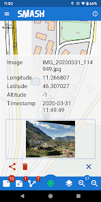
* gives the possibility to take geo-referenced and possibly orientated pictures during a survey, with further possibility to import them into GIS applications like gvSIG
* is able to easily exploit an Internet connection, if available
* is extremely easy to use and intuitive, providing just few important functions
The main features available in SMASH are:
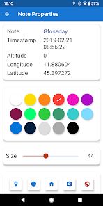
* geo-referenced notes
* geo-referenced and oriented pictures
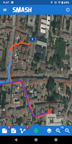
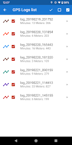
* gps track logging
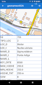
* form-based data surveys
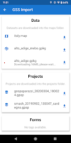
* easy export of collected data
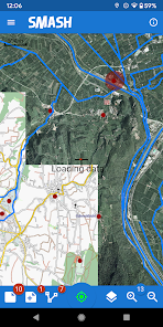
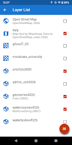
* a map view for navigation with support for raster tiles and gpx vector data
* geopackage (OGC standard) support
The main aim of SMASH is to have a tool that:
* fits in any pocket and can be always at hand, when needed
* gives the possibility to take geo-referenced and possibly orientated pictures during a survey, with further possibility to import them into GIS applications like gvSIG
* is able to easily exploit an Internet connection, if available
* is extremely easy to use and intuitive, providing just few important functions
The main features available in SMASH are:
* geo-referenced notes
* geo-referenced and oriented pictures
* gps track logging
* form-based data surveys
* easy export of collected data
* a map view for navigation with support for raster tiles and gpx vector data
* geopackage (OGC standard) support
Aktualisiert am
Was die Sicherheit angeht, solltest du als Erstes verstehen, wie Entwickler deine Daten erheben und weitergeben. Die Datenschutz- und Sicherheitspraktiken können je nach deiner Verwendung, deiner Region und deinem Alter variieren. Diese Informationen wurden vom Entwickler zur Verfügung gestellt und können jederzeit von ihm geändert werden.

Keine Daten werden mit Drittunternehmen oder -organisationen geteilt

Keine Daten erhoben
Neuigkeiten
This is the last release on the Play Store. Future releases will be on the F-Droid store.
Release notes:
* new geometries inside forms (polygon, line, point)
* zoom tile maps beyond max zoomlevel through scaling
* geojson layer support
* new 'current log' panel size
* box selection on info tool
* more efficient and clean toolbar
* better online sources handling and recover
* length and area in feature info
* url based combo boxes in forms
* many many fixes