Trainsity Osaka
જાહેરાતો ધરાવે છે
1 હજાર+
ડાઉનલોડ

પ્રત્યેક
info
આ ઍપનું વર્ણન
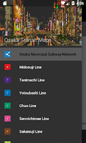
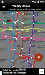
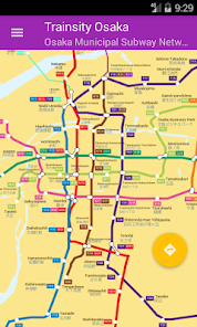
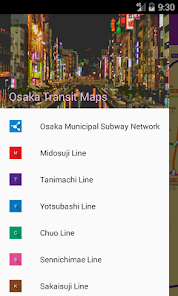
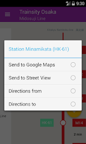
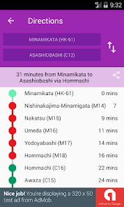
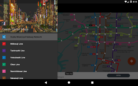
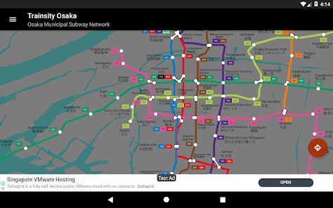
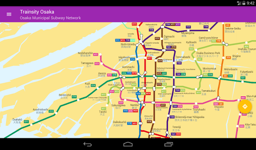
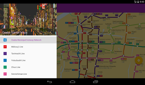
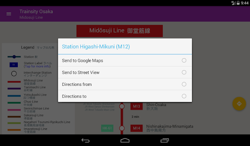
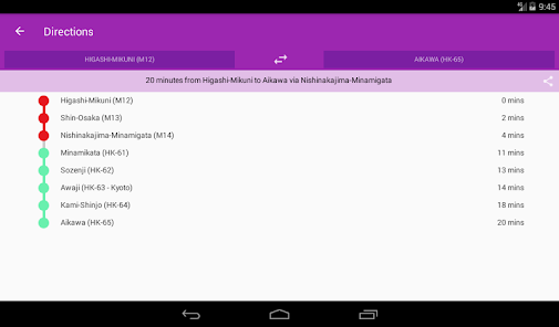
Find your way around Osaka city's subway using the high resolution vector maps of the train network. The following metro rail lines are available: Midosuji, Tanimachi, Yotsubashi, Chuo, Sennichimae, Sakaisuji, Nagahori-Tsurumi-ryokuchi, Imazatosuji, Newtram Nanko Port Town, Kita Osaka Kyuko, Kintetsu Keihanna, Hankyu Kyoto, Hankyu Senri, Osaka Monorail, and Kitakyu Namboku lines. The maps have small file size footprints but with many levels of zoom and can work offline without connecting to the Internet. Users can click the train station box labels to open Google Maps or Google StreetView, where they can use all the functions of the Google apps to visualize the surrounding area and/or perform routing for directions. There is also an offline function to calculate the best way to travel from a station to another station with a direction breakdown and timings (which may vary from the actual travelling time).
* Now with dark mode setting.
* Now with dark mode setting.
આ રોજ અપડેટ કર્યું
ડેવલપર તમારો ડેટા કેવી રીતે એકત્રિત અને શેર કરે છે, તે સમજવાથી સુરક્ષાની શરૂઆત થાય છે. તમારા દ્વારા ઍપનો ઉપયોગ, ઉપયોગ થાય તે પ્રદેશ અને તમારી ઉંમરના આધારે ડેટાની પ્રાઇવસી અને સુરક્ષા પદ્ધતિઓ અલગ-અલગ હોઈ શકે છે. ડેવલપર દ્વારા આ માહિતી પ્રદાન કરવામાં આવી છે અને તેઓ સમયાંતરે તેને અપડેટ કરી શકે છે.


નવું શું છે?
Upgrade to API 34.


