W1ANT Satellite Tracker
Contient des annonces
4,0star
93 avis
10K+
Téléchargements

Tout public
info
À propos de l'application
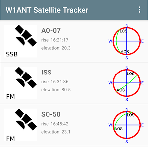
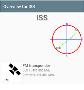
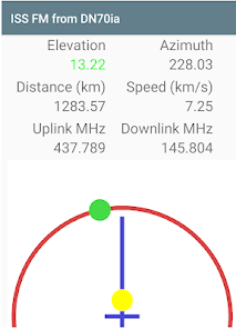
Get a list of Amateur Radio satellites visible from your current location in the next 24 hours. Get an overview over their paths from acquisition to loss of signal (AOS to LOS). Only passes above the minimum elevation are shown on the list. Select one of them and get information on their on-board radios. Select one of their radios and be able to point your phone directly at it so you can easily operate it. Extra information, i.e. the actual frequencies to use for uplink and downlink is also presented taken the Doppler effect into account.
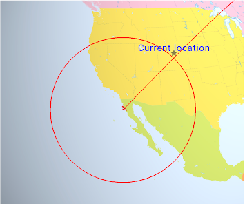
The Location view on the Satellite Overview page shows the current position of the satellite over Earth including the circle that demarcates the area where it is above 10 degrees above the horizon (reachable by radio). This view also shows its path for the next 60 minutes. Pinch to zoom and drag to change your point of view over Earth.
There is also a Passes view on the Overview page that lists all passes where this satellite will be over the horizon at the current location in the next 48 hours.
The minimum elevation for the starting list can be changed from its default 10 degrees in the Settings.
Date de mise à jour
La sécurité, c'est d'abord comprendre comment les développeurs collectent et partagent vos données. Les pratiques concernant leur confidentialité et leur protection peuvent varier selon votre utilisation, votre région et votre âge. Le développeur a fourni ces informations et peut les modifier ultérieurement.

Aucune donnée partagée avec des tiers
En savoir plus sur la manière dont les développeurs déclarent le partage

Aucune donnée collectée
En savoir plus sur la manière dont les développeurs déclarent la collecte
Notes et avis
4,0
92 avis
Nouveautés
Minor bug fixes and target for Android 14.