Trafmon in Maryland
Contient des annonces
3,8star
14 avis
1K+
Téléchargements

Tout public
info

À propos de l'application
** Disclaimer: This app does not represent any government entity. **
Note: Traffic data source for the app comes from the Maryland Department of Transportation's Coordinated Highways Action Response Team . For more detailed information about the traffic data, visit https://chart.maryland.gov/DataFeeds/GetDataFeeds. (Please note that the website is only accessible from within the USA). The weather imagery data comes from the National Oceanic and Atmospheric Administration (NOAA). The imagery source website is https://nowcoast.noaa.gov/.
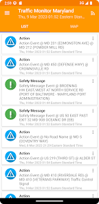
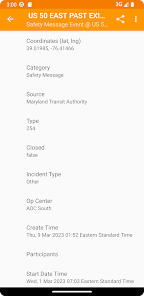
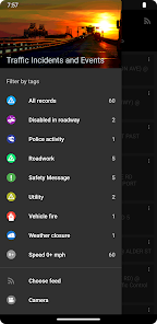
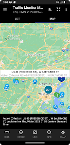
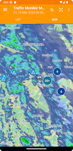
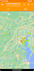
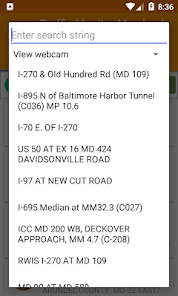
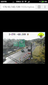
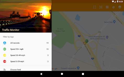
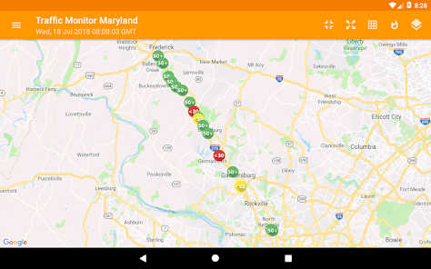
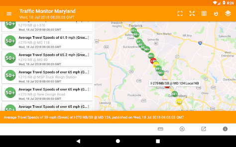
Users can monitor information about traffic incidents and events, active road closures, average travel speeds on Maryland's highway system using this app. The traffic information can be viewed as a text list, or on a map as icons.
Note: Traffic data source for the app comes from the Maryland Department of Transportation's Coordinated Highways Action Response Team . For more detailed information about the traffic data, visit https://chart.maryland.gov/DataFeeds/GetDataFeeds. (Please note that the website is only accessible from within the USA). The weather imagery data comes from the National Oceanic and Atmospheric Administration (NOAA). The imagery source website is https://nowcoast.noaa.gov/.
Users can monitor information about traffic incidents and events, active road closures, average travel speeds on Maryland's highway system using this app. The traffic information can be viewed as a text list, or on a map as icons.
Date de mise à jour
La sécurité, c'est d'abord comprendre comment les développeurs collectent et partagent vos données. Les pratiques concernant leur confidentialité et leur protection peuvent varier selon votre utilisation, votre région et votre âge. Le développeur a fourni ces informations et peut les modifier ultérieurement.

Aucune donnée partagée avec des tiers
En savoir plus sur la manière dont les développeurs déclarent le partage

Aucune donnée collectée
En savoir plus sur la manière dont les développeurs déclarent la collecte

Les données sont chiffrées lors de leur transfert

Impossible de supprimer les données
Notes et avis
3,7
13 avis
Nouveautés
Upgrade to Android API 34.
Upgrade to Maps 18.2.0.
Fix feed downloading.
Upgrade to Maps 18.2.0.
Fix feed downloading.


