MGRS Live Map and Mil. Compass
5K+
Téléchargements

Tout public
info
À propos de l'application
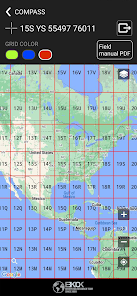
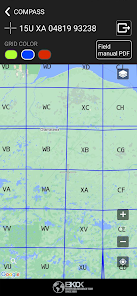
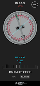
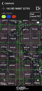
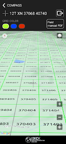
MGRS live map and military compass offered by the MGRS are crucial tools for NATO militaries to locate points on Earth using a standardized geocoordinate system. The MGRS system is derived from the UTM and UPS grids, but has a unique labeling convention. This system provides geocodes for the entire Earth and uses grid squares of different sizes, ranging from 1 meter to 10 kilometers, based on the level of precision required.
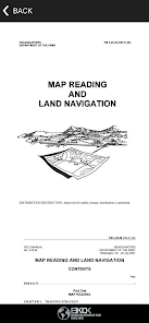
Included in the app is the field manual FM 3-25.26 (FM 21-26), which focuses on map reading and land navigation. The manual aims to provide a standardized reference for all soldiers in the Army, regardless of service branch, MOS, or rank. It contains both doctrine and training guidance on map reading and land navigation. Part One of the manual addresses map reading, while Part Two focuses on land navigation. The appendixes provide additional resources, including a list of training materials, a matrix of land navigation tasks, an introduction to orienteering, and information on devices that can assist soldiers in navigating the terrain.
Included in the app is the field manual FM 3-25.26 (FM 21-26), which focuses on map reading and land navigation. The manual aims to provide a standardized reference for all soldiers in the Army, regardless of service branch, MOS, or rank. It contains both doctrine and training guidance on map reading and land navigation. Part One of the manual addresses map reading, while Part Two focuses on land navigation. The appendixes provide additional resources, including a list of training materials, a matrix of land navigation tasks, an introduction to orienteering, and information on devices that can assist soldiers in navigating the terrain.
Date de mise à jour
La sécurité, c'est d'abord comprendre comment les développeurs collectent et partagent vos données. Les pratiques concernant leur confidentialité et leur protection peuvent varier selon votre utilisation, votre région et votre âge. Le développeur a fourni ces informations et peut les modifier ultérieurement.


Nouveautés
Improved app performance.


