LiDAR VR Viewer
Achats via l'appli
3,7star
1,12K avis
50K+
Téléchargements

Tout public
info
À propos de l'application
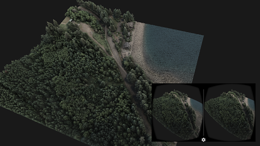
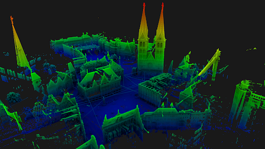
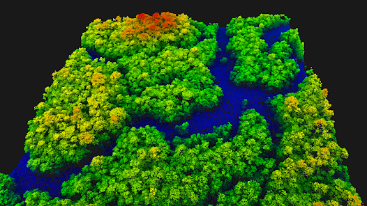
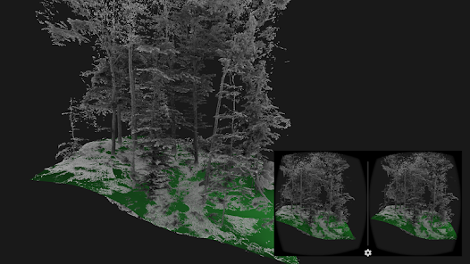
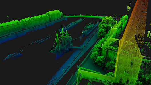
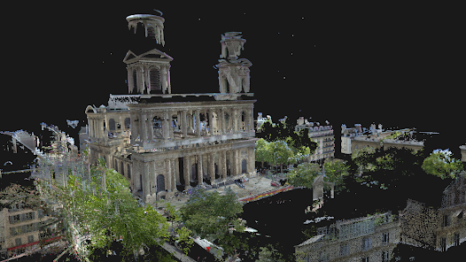
LiDAR VR Viewer is dedicated to the visualization of point clouds and surfaces as an immersive experience through virtual reality. With a Bluetooth controller and a simple head-mounted display such as Google cardboard, it turns into a powerful tool to investigate and explore 3D data.
A scientific paper describing this app has been published in the proceedings of the 11th International Conference on Computer Graphics, Visualization, Computer Vision and Image Processing (2017)
Features :
• Developed for virtual reality head mounted displays such has Google Cardboard
• All-native rendering utilizing OpenGL ES 2.0
• Supports point cloud ASCII files
• Colors the points from elevation, intensity or RGB values
• Supports point cloud with normals, rendered as surfel (work in progress)
• Supports point clouds up to few millions points (depends on the smartphone GPU)
• Supports surface mesh Wavefront .obj files
• Control camera movement with Blue-tooth controller or touchscreen
• * New * Demo files download-able from the start screen
• * New * Button mapping of blue-tooth controller detailed in the start screen menu
• * New * Casting mode to broadcast the 3D model on TV (requires a controller)
Note :
The currently supported input ASCII files are as follows, without header (The columns must be separated by space character : " ")
• 3 columns X Y Z :
1.234 2.567 3.891
• 4 columns X Y Z intensity (float) :
1.234 2.567 3.891 0.2
• 6 columns X Y Z R G B [0-255] :
1.234 2.567 3.891 125 250 135
• 6 columns X Y Z Nx Ny Nz (coordinates + normals):
1.234 2.567 3.891 0.11 0.07 0.91
Date de mise à jour
La sécurité, c'est d'abord comprendre comment les développeurs collectent et partagent vos données. Les pratiques concernant leur confidentialité et leur protection peuvent varier selon votre utilisation, votre région et votre âge. Le développeur a fourni ces informations et peut les modifier ultérieurement.

Aucune donnée partagée avec des tiers
En savoir plus sur la manière dont les développeurs déclarent le partage

Aucune donnée collectée
En savoir plus sur la manière dont les développeurs déclarent la collecte
Notes et avis
3,7
1,11K avis
Nouveautés
Cel shading is now combined with SSAO for a better visual result
Previous version:
- Bug fix: openGL depth got buggy in the last version
- Experimental feature: cel shading to enhance the point clouds visualization
- Screen touch control now available again
- Added one extra demo dataset: 4 millions points forest LiDAR scan
Previous version:
- Bug fix: openGL depth got buggy in the last version
- Experimental feature: cel shading to enhance the point clouds visualization
- Screen touch control now available again
- Added one extra demo dataset: 4 millions points forest LiDAR scan