

Agritempo

10K+
Downloads

Everyone
info
About this app
The mobile application Agritempo - agro-meteorological Monitoring System - allows users to access via the Internet to weather and agro-meteorological information from various municipalities and states. In addition to reporting the current climate situation, the system database supports the development of the recommendations of the Agricultural Zoning Climate Risk (ZARC), a policy supported by the Ministry of Agriculture, Livestock and Supply of Brazil.
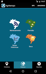
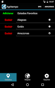
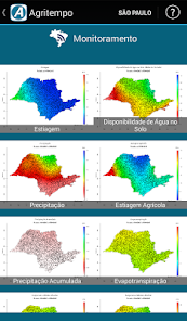
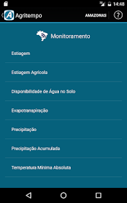
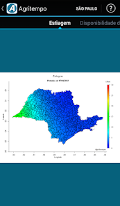
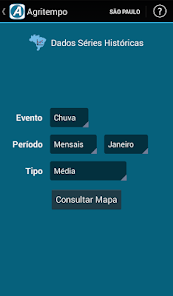
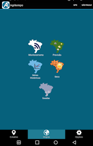
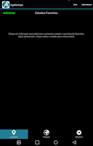
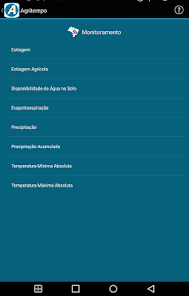
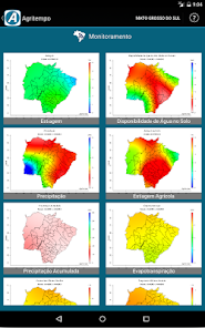
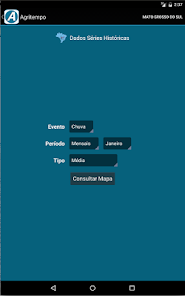
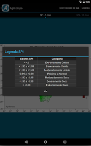
This application has the following features: monitoring maps, weather maps, drought index maps and historical rainfall. Additionally, the user can select the states you want to see and also check the maps available for your location (latitude and longitude) via GPS (Global Positioning System).
This application has the following features: monitoring maps, weather maps, drought index maps and historical rainfall. Additionally, the user can select the states you want to see and also check the maps available for your location (latitude and longitude) via GPS (Global Positioning System).
Updated on
Safety starts with understanding how developers collect and share your data. Data privacy and security practices may vary based on your use, region, and age. The developer provided this information and may update it over time.

No data shared with third parties
Learn more about how developers declare sharing

No data collected
Learn more about how developers declare collection
What's new
- Alteração no layout da tela principal.
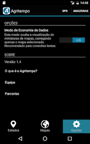
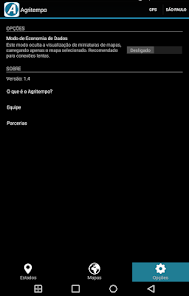
- Nova opção de economia de dados: possibilita o carregamento de mapas individualmente
- Correção dos mapas de Secas
- Melhorias no sistema de localização por GPS
- Correção de bugs
- Nova opção de economia de dados: possibilita o carregamento de mapas individualmente
- Correção dos mapas de Secas
- Melhorias no sistema de localização por GPS
- Correção de bugs


