Trainsity Osaka
اشتہارات شامل ہیں
+1 ہزار
ڈاؤن لوڈز

ہر کوئی
info
اس ایپ کے بارے میں
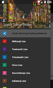
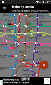
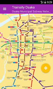
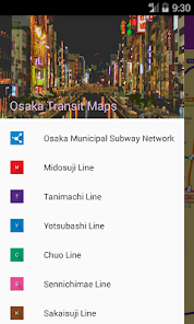
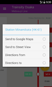
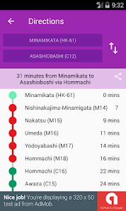
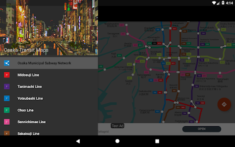
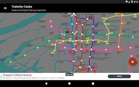
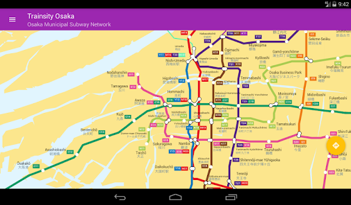
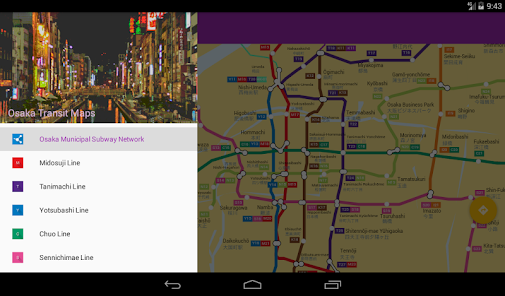
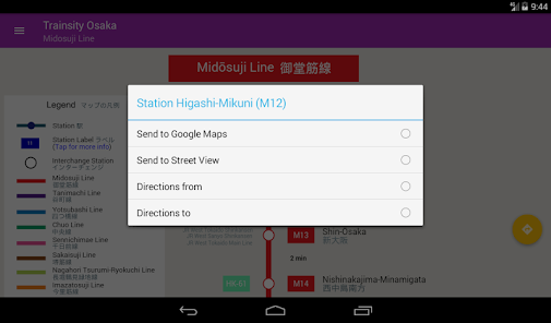
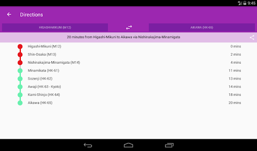
Find your way around Osaka city's subway using the high resolution vector maps of the train network. The following metro rail lines are available: Midosuji, Tanimachi, Yotsubashi, Chuo, Sennichimae, Sakaisuji, Nagahori-Tsurumi-ryokuchi, Imazatosuji, Newtram Nanko Port Town, Kita Osaka Kyuko, Kintetsu Keihanna, Hankyu Kyoto, Hankyu Senri, Osaka Monorail, and Kitakyu Namboku lines. The maps have small file size footprints but with many levels of zoom and can work offline without connecting to the Internet. Users can click the train station box labels to open Google Maps or Google StreetView, where they can use all the functions of the Google apps to visualize the surrounding area and/or perform routing for directions. There is also an offline function to calculate the best way to travel from a station to another station with a direction breakdown and timings (which may vary from the actual travelling time).
* Now with dark mode setting.
* Now with dark mode setting.
اپ ڈیٹ کردہ بتاریخ
سیفٹی اس بات کو سمجھنے کے ساتھ شروع ہوتی ہے کہ ڈویلپرز آپ کا ڈیٹا کیسے اکٹھا اور اس کا اشتراک کرتے ہیں۔ ڈیٹا کی رازداری اور سیکیورٹی کے طریقے آپ کے استعمال، علاقے اور عمر کی بنیاد پر مختلف ہو سکتے ہیں۔ ڈویلپر نے یہ معلومات فراہم کی ہے اور وقت کے ساتھ ساتھ اسے اپ ڈیٹ کر سکتا ہے۔

فریقین ثالث کے ساتھ کسی بھی ڈیٹا کا اشتراک نہیں کیا گیا
ڈویلپرز کے اشتراک کے اعلان کے بارے میں مزید جانیں

کوئی ڈیٹا اکٹھا نہیں کیا گیا
ڈویلپرز کے اکٹھا کرنے کے اعلان کے طریقے بارے میں مزید جانیں

ٹرانزٹ میں ڈیٹا مرموز کردہ ہے

ڈیٹا حذف نہیں کیا جا سکتا
نیا کیا ہے
Upgrade to API 34.


