
BayCurrents
100+
Yuklanmalar

Hamma uchun
info


Bu ilova haqida
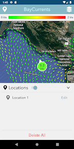
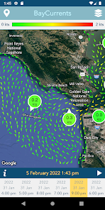
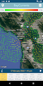
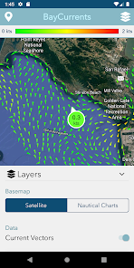
Baycurrents is a mobile app for displaying maps of high resolution surface currents within the San Francisco Bay. The app is intended to support a wide range of maritime activities, from recreational fishing and sailing to the operation of professional transport vessels. The source for the surface current data is a numerical model operated by the National Oceanic & Atmospheric Administration (NOAA). The model benefits from oceanographic high-frequency radar (HFR) measurements from the Central & Northern California Ocean Observing System (CeNCOOS) HFR Network, along with the other observations such as tides and wind. The resulting dataset contains current vector fields for hourly timestamps ranging from the recent past, to the present and up to 48 hours in the future. The complete vector dataset is downloaded by the app to allow autonomous offline operation.
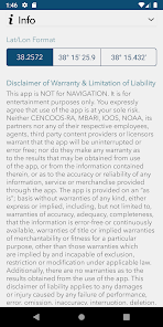
This app contains experimental data and is NOT for navigational purposes.
This app contains experimental data and is NOT for navigational purposes.
Oxirgi yangilanish
Xavfsizlik — dastur ishlab chiquvchilar maʼlumotlaringizni qanday jamlashi va ulashishini tushinishdan boshlanadi. Maʼlumotlar maxfiyligi va xavfsizlik amaliyotlari ilovadan foydalanish, hudud va yoshga qarab farq qilishi mumkin. Bu axborot dastur ishlab chiquvchi tomonidan taqdim etilgan va keyinchalik yangilanishi mumkin.


Nima yangiliklar
Added support for latest Android version.
