VICFires
10K+
Downloads

Everyone
info


About this app
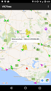
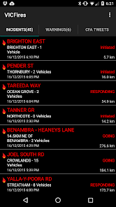
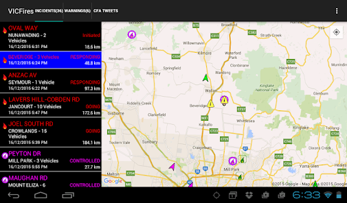
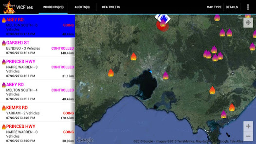
This application is designed to provide up to date information about bush fire data in Victoria, Australia for users of Android devices.
It utilises data from the Victorian Country Fire Authority/Victorian Department of Sustainability data feeds on fires with your current location provided by the phone GPS.
Using this information the application is able to provide a list of fires showing the nearest ones first, helping you to understand your current situation.
The information is reliant on both the accuracy of the phone's GPS and the data recorded on the CFA's website.
This application does not cache any data, so Internet access (either Wireless. or 3G) is required to access the data.
Be aware that while P4G has utilised "best efforts" to provide this information to you, it is not intended to replace other sources of information on the fire situation near you. Also remember that fire and weather can change quickly.
All data is provided Copyright from the Victorian Country Fire Authority and the Victorian Department of Sustainability.
Follow P4G on twitter at P4G_Apps
Updated on
Safety starts with understanding how developers collect and share your data. Data privacy and security practices may vary based on your use, region, and age. The developer provided this information and may update it over time.

No data shared with third parties
Learn more about how developers declare sharing

This app may collect these data types
Device or other IDs

Data is encrypted in transit

Data can’t be deleted


