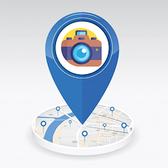
GPS Camera Map: Geotag Photos
1万+
次下载

适合所有人
info


关于此应用
The GPS Camera Map Geotag Photos is the ultimate app for capturing and tagging your memories with precise GPS location details. GPS coordinates app combines the power of a GPS location with a highly efficient map camera, making it easy to add a location stamp to your photos. With the camera geotag feature, every photo you take is automatically embedded with GPS coordinates, ensuring your images always display the exact camera location. Whether you're traveling, exploring, or documenting, the app provides an intuitive way to use a GPS camera to capture and geotag your adventures with ease.
The GPS coordinates app ensures that each photo you take is enriched with real-time location data, creating an accurate GPS location record. The geotag photos functionality makes it perfect for travelers, photographers, and professionals who need precise location tracking for their images. With a user-friendly interface, the GPS camera offers seamless integration of mapping tools, making it easy to navigate your pictures by location. The ability to include a location stamp directly on your photos transforms your images into informative and shareable memories.
Main Feature of GPS camera Map Geotag Photo app
Capture picture with current location information
Share current location
Save memories with location, date, and time
Also check the longitude and latitude of current location
Relive and Organize Your Adventures
With the GPS camera, relive your experiences by viewing photos alongside detailed GPS location overlays. The camera geotag system allows for easy sorting and organizing of photos by specific GPS coordinates. Outdoor enthusiasts, travel photographers, and professionals alike will benefit from the accurate GPS camera location features, making it a valuable asset for documenting journeys or projects.
Perfect for Every Explorer and Professional
The GPS coordinates app ensures you never lose track of where your memories were made. The GPS camera functionality combines advanced location tracking with photography in a user-friendly package. The geotag photos and camera location tools make it simple to transform your images into data-rich, shareable memories with a professional touch.
Experience the ultimate combination of photography and geotagging with the GPS Camera Map: Geotag Photos app. Add precise GPS location and camera geotag details to your photos, and start capturing the world with accuracy and convenience!
更新日期


应用支持
phone
电话号码
+923018585020
开发者信息
XTREME SOFTWARE SERVICES (PRIVATE) LIMITED
muhibxtreme@gmail.com
4th floor, Zaad Plaza, Abdara Road
Peshawar, 25000
Pakistan
+92 347 4019932


