
Szlaki - Mapa turystyczna
Contains adsIn-app purchases
100K+
Downloads

Teen
info


About this app
Tourist map of hiking trails
Tourist trails in Poland, the Czech Republic and Slovakia.
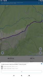
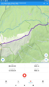
Trails is an application for planning mountain trips, recording routes and collecting peaks conquered. With the application you can:
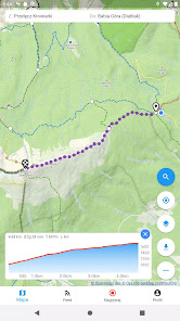
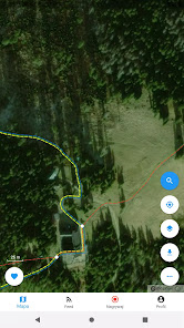
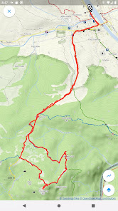
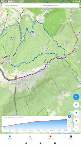
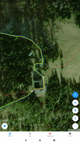
◾ Designate and plan hiking trips on and off mountain trails
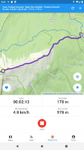
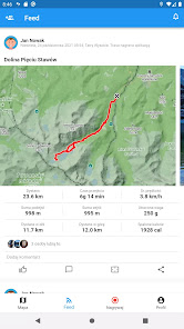
◾ Find out the route's elevation gain, distance and walking time
◾ Save planned routes "for later"
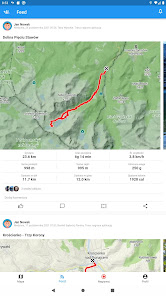
◾ Share planned and completed routes with friends
◾ Record your trips and check how many calories you burned and how much weight you lost
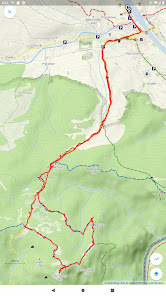
◾ Mark routes as completed
◾ Import your routes from the Apple Fitness app (HealthKit), Strava or from a GPX file
◾ Track your friends' activity and send them the routes you have traveled together
◾ Download offline maps of popular regions to feel safe on the trail even when there is no internet (premium)
◾ View the most frequently used trails and starting points on the map layer (premium)
◾ View routes you have already traveled on the map layer (premium)
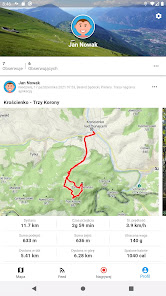
◾ Track your own and others' statistics, such as: peaks climbed by mountain range, number of activities, distance traveled, elevation gain and calories burned yearly and overall (partially in premium)
◾ Collect conquered peaks and track your progress in popular mountain crowns, including: in the "Korona Gór Polskich", "Diadem Polish Mountains", "Tourist Crown of the Tatras", "Korona Beskidu Wyspowy", etc. (partly in premium)
The map area includes Poland, Czech Republic and Slovakia.
The map of mountain trails includes, among others: mountain ranges:
◾ Beskid Makowski
◾ Beskid Mały
◾ Beskid Niski
◾ Beskid Sądecki
◾ Beskid Śląski
◾ Beskid Śląsko-Morawski
◾ Beskid Wyspowy
◾ Beskid Żywiecki
◾ Bieszczady Mountains
◾ Gorce
◾ Bardzkie Mountains
◾ Bystrzyckie Mountains
◾ Orlické Mountains
◾ Jizera Mountains
◾ Kaczawskie Mountains
◾ Stone Mountains
◾ Opawskie Mountains
◾ Owl Mountains
◾ Table Mountains
◾ Wałbrzyskie Mountains
◾ Golden Mountains
◾ Bialskie Mountains
◾ Karkonosze Mountains
◾ Pieniny Mountains
◾ Tatra Mountains
Updated on
Safety starts with understanding how developers collect and share your data. Data privacy and security practices may vary based on your use, region, and age. The developer provided this information and may update it over time.

No data shared with third parties
Learn more about how developers declare sharing

This app may collect these data types
Location, Personal info and 3 others

Data is encrypted in transit

You can request that data be deleted
What's new
- Nowy sposób planowania trasy
- Zmiany w nawigacji na profilu
- Zmiany w nawigacji na profilu
App support
About the developer
W3media.pl spółka cywilna Mariusz Turek, Bartosz Stasiurka
kontakt@w3media.pl
15 Aleja Powstania Warszawskiego
31-539 Kraków
Poland
+48 512 726 708