
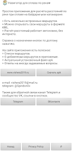
Навигатор для сплава по рекам

10K+
Downloads

Everyone
info
About this app
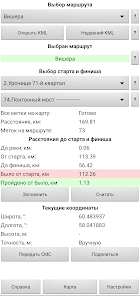
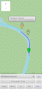
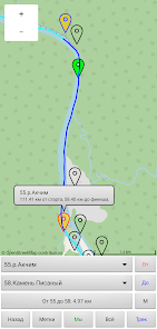
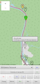
Alloy meter. Navigator for river rafting. Application for water tourists. Calculates the distance along the rafting route. Contains several river routes for kayaking or catamaran rafting. Distances are calculated from the route between the markers and the current position. The route is displayed on the map. Autonomous operation without the Internet and cellular networks.
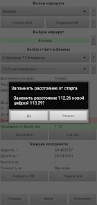
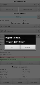
Note! This is a one-dimensional navigator, only for calculating distances along a pre-prepared route. The application includes several dozen routes along popular rivers. The user can open his route file in KML format (Google Earth Pro format). The application does not know how to plot a route along a river from an arbitrary point A to point B. Information about adding rivers (routes) on the application website.
List of rivers (routes)
Ural-South
Ai, Belaya, Bolshaya Satka, Zilim ©, Inzer (Big), Inzer (Small), Nugush, Sakmara, Yuryuzan (to Zavyalikha), Yuryuzan (from the city of Yuryuzan).
Ural
Akchim (+Vishera) ©, Berezovaya, Vizhay, Vilva, Vishera, Kama, Koiva, Kolva, Kosva, Lobva, Mezhevaya Utka, Neiva, Dir, Serga, Serebryanka, Sylva, Tagil, Uls, Usa, Usva, Ufa, Chusovaya, Yazva, Yayva.
Asia
Biya, Vakh, Zhom-Bolok, Zeya (to the village of Bomnak), Zeya (from the village of Chagoyan), Kazyr-Tuba, Kolikyogan, Lena, Mana, Oka Sayanskaya, Onot-Belaya, Ursul-Katun, Chumysh.
Europe
Velya-Resseta-Zhizdra, Ilevna, Ilet ©, Skating rink, Kerzhenets, Kilmez, Kirzhach, Klyazma, Korozhechna, Lukh, Moscow 2023, Moscow, Nerl, Nerskaya, Oka, Osuga, Pinega, Fields, Pra, Selizharovka-Volga, Serdoba- Khoper, Tvertsa, Thames, Darkness, Uleima-Yukhot, Upa.
Europe-South
Don, Ursa, Tereshka, Khoper (Bekovo-Arkadak), Khoper (Borisoglebsk-Novokhopersk).
Updated on
Safety starts with understanding how developers collect and share your data. Data privacy and security practices may vary based on your use, region, and age. The developer provided this information and may update it over time.

No data shared with third parties
Learn more about how developers declare sharing

No data collected
Learn more about how developers declare collection

Committed to follow the Play Families Policy
What's new
Добавлен маршрут по реке Сакмара. Сакмара — река в Башкирии и Оренбургской области, правый приток реки Урал. Впадает в реку Урал по правому берегу в 327 км от её устья.
