
NAFI V2
1K+
Downloads

Everyone
info


About this app
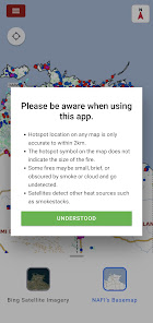
The NAFI app brings fire information resources for land managers in Australia to your phone, allowing you to keep a constant eye on bushfire threats. As a pastoralist, grazier, indigenous ranger, conservation scientist or member of the public, you can view maps of fire activity (hotspots) and burnt areas (fire scars) provided by the North Australia and Rangelands Fire Information (NAFI) service. This is beta release of new version of NAFI app.
Updated on
Safety starts with understanding how developers collect and share your data. Data privacy and security practices may vary based on your use, region, and age. The developer provided this information and may update it over time.

No data shared with third parties
Learn more about how developers declare sharing

No data collected
Learn more about how developers declare collection
What’s new
- Added 10 minute hotspots as menu option.
- Fixed bugs and issues.
- Updated app performance.
- Fixed bugs and issues.
- Updated app performance.
App support
About the developer
CHARLES DARWIN UNIVERSITY
cdudev@cdu.edu.au
Red Building G 1 Ellengowan Drive
Brinkin NT 0810
Australia
+61 418 867 438