GIS SHedit
1K+
Downloads

Everyone
info
About this app
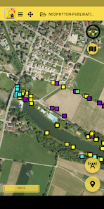
With the GIS SHedit app, authorized users can capture geodata of specific topics on the go and on-site.
Welcome to the geographical information platform of the canton of Schaffhausen. GIS SH is the abbreviation for "Geographical Information System Schaffhausen" and offers you two-dimensional views with georeferenced and interactive maps.
Edit stands for editing, so that new geodata can be recorded and changed.
In order to be able to record geodata for a specific topic, the user needs a user account which he can apply to the Office for Geoinformation.
Hints:
==========
* The maps and geodata offered are limited to the Canton of Schaffhausen
* Only geodata in the canton can be recorded
* A mobile data connection is required to use the GIS SHedit app. There may be fees
Features:
==========
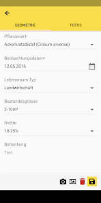
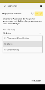
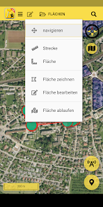
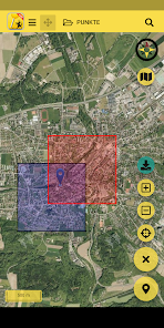
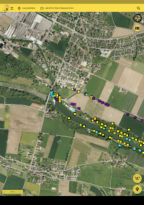
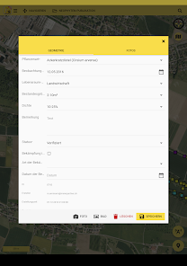
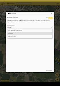
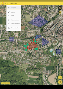
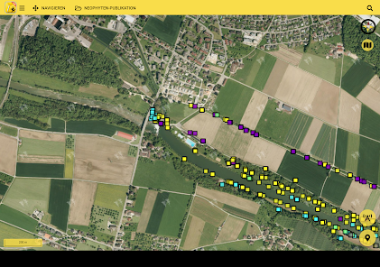
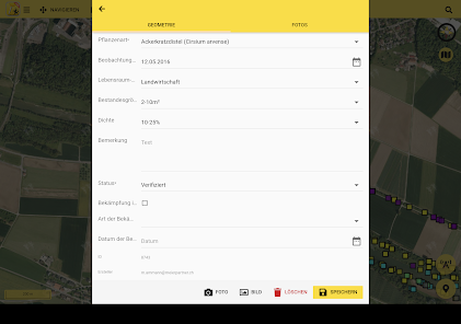
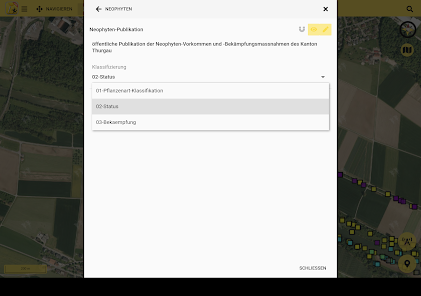
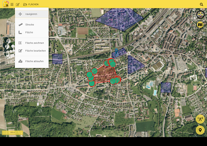
* Acquisition and processing of point, line and surface geometries, including information on them
* Capture photos for each geometry directly in the app
* Measure distance and area
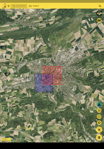
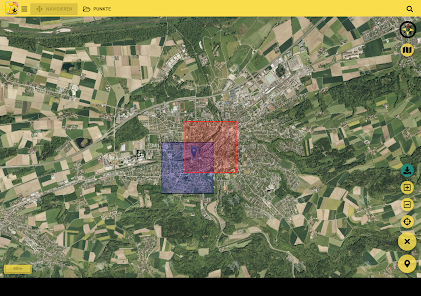
* Different background map views: orthophoto, open street map
* Search for locations
* GPS localization
* Offline use
This app is based on Sabretooth from Kaden & Partner AG https://www.sabretooth.ch/
Welcome to the geographical information platform of the canton of Schaffhausen. GIS SH is the abbreviation for "Geographical Information System Schaffhausen" and offers you two-dimensional views with georeferenced and interactive maps.
Edit stands for editing, so that new geodata can be recorded and changed.
In order to be able to record geodata for a specific topic, the user needs a user account which he can apply to the Office for Geoinformation.
Hints:
==========
* The maps and geodata offered are limited to the Canton of Schaffhausen
* Only geodata in the canton can be recorded
* A mobile data connection is required to use the GIS SHedit app. There may be fees
Features:
==========
* Acquisition and processing of point, line and surface geometries, including information on them
* Capture photos for each geometry directly in the app
* Measure distance and area
* Different background map views: orthophoto, open street map
* Search for locations
* GPS localization
* Offline use
This app is based on Sabretooth from Kaden & Partner AG https://www.sabretooth.ch/
Updated on
Safety starts with understanding how developers collect and share your data. Data privacy and security practices may vary based on your use, region, and age. The developer provided this information and may update it over time.

No data shared with third parties
Learn more about how developers declare sharing

This app may collect these data types
Personal info, Photos and videos and 2 others

Data is encrypted in transit

Data can’t be deleted
What's new
* neu: Neue Berechtigung: lesen (eigene), lesen (Gruppe), lesen & schreiben (Gruppe)
* bugfix: Berechtigung zum erstellen & löschen von Projekten
* bugfix: Berechtigung zum erstellen & löschen von Projekten
App support
About the developer
Kaden und Partner AG
it@kadenpartner.ch
Bahnhofstrasse 43
8500 Frauenfeld
Switzerland
+41 52 720 90 50