
Quy hoạch Bình Định
1K+
Downloads

Everyone
info


About this app
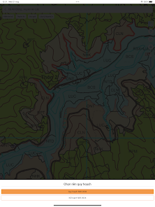
- Look up the latest updated planning information
- Look up planning information by boundary corner coordinates.
- Look up planning information by sheet number - plot number.
- Detailed land use planning map by district/ward/commune.
- Support viewing planning maps in satellite & traffic mode.
- Easily grasp population density, roads with satellite view mode.
- Link directions on the map.
- View list of adjacent plots.
- Disclaimer: This application does not represent the government organization of Khanh Hoa province. The data is for reference only.
- Information source: https://hochiminhcity.gov.vn
Updated on
Safety starts with understanding how developers collect and share your data. Data privacy and security practices may vary based on your use, region, and age. The developer provided this information and may update it over time.

No data shared with third parties
Learn more about how developers declare sharing

No data collected
Learn more about how developers declare collection

Data is encrypted in transit

You can request that data be deleted
What’s new
Sửa lỗi định vị và tối ưu hiệu suất
App support
About the developer
Thạch Thên
thachthen@gmail.com
Vietnam


