CMC RIMS
5.0star
8 reviews
500+
Downloads

Everyone
info


About this app
The Colorado Mountain Club's Recreation Impact Monitoring System (CMC RIMS) is the place where grass roots citizen scientists capture observable data to help public land managers monitor trails, campsites and natural resources. CMC RIMS gives you the opportunity to collect data in a structured, assessment format and provide detailed information for Federal, State, and local land management organizations. CMC RIMS is your advocacy and conservation tool to help steward our public lands - improving recreational experiences and preserving natural resources for future generations. CMC RIMS supports individual user and organizational data capture and use goals. For organizations that are interested in setting up data collection and use plans, contact CMC at conservation@cmc.org.
CMC RIMS free features include:
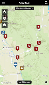
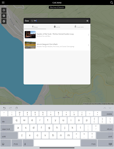
• Map based interface with online & offline GPS locating
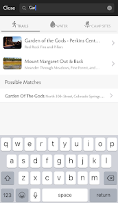
• Search for Trailheads, Water Access & Campsites near you
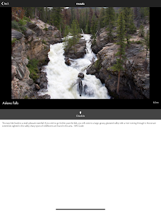
• "Check-In" to record your current recreation activity and assist with visitor use monitoring
• Upload images
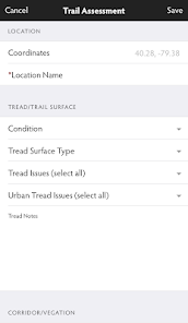
In addition to the free features, CMC RIMS volunteer "monitoring" features include adding data to assess and inventory:
• Trails
• Campsites
• Water access points
• Signs and facilities
• Visitor use
CMC provides training on how to complete assessments. Upon completion of this training, volunteers will be dubbed as trained citizen scientists and provided access to monitoring features within the app. For more information on volunteering and training, contact CMC at www.cmc.org/app.
CMC RIMS is a collaborative effort between the Colorado Mountain Club and CANA Analytics. For more information on CMC's mission and role in conservation, visit www.cmc.org/app. For more information on CANA, visit www.canaadvisors.com.
CMC RIMS free features include:
• Map based interface with online & offline GPS locating
• Search for Trailheads, Water Access & Campsites near you
• "Check-In" to record your current recreation activity and assist with visitor use monitoring
• Upload images
In addition to the free features, CMC RIMS volunteer "monitoring" features include adding data to assess and inventory:
• Trails
• Campsites
• Water access points
• Signs and facilities
• Visitor use
CMC provides training on how to complete assessments. Upon completion of this training, volunteers will be dubbed as trained citizen scientists and provided access to monitoring features within the app. For more information on volunteering and training, contact CMC at www.cmc.org/app.
CMC RIMS is a collaborative effort between the Colorado Mountain Club and CANA Analytics. For more information on CMC's mission and role in conservation, visit www.cmc.org/app. For more information on CANA, visit www.canaadvisors.com.
Updated on
Safety starts with understanding how developers collect and share your data. Data privacy and security practices may vary based on your use, region, and age. The developer provided this information and may update it over time.

No data shared with third parties
Learn more about how developers declare sharing

This app may collect these data types
Location, Personal info, and Photos and videos

Data is encrypted in transit

You can request that data be deleted
Ratings and reviews
5.0
8 reviews

Julie Mach
- Flag inappropriate
May 14, 2020
Great tool to collect information while you're out hiking/biking/camping on public lands. Fast and easy to use, includes pictures and GPS coordinates, sharing features and editing functions.
1 person found this review helpful

Felicia B
- Flag inappropriate
September 26, 2021
Easy to use and a great way to help with conservation efforts!
1 person found this review helpful

Steve Boyle
- Flag inappropriate
June 21, 2022
Our volunteer trail group uses RIMS to record trail problems and share data. Easy and realtine.
What's new
New assessment type added (ATC Overnight Site Assessment)