Ledningsinfo LER (ler.dk) kort

Everyone
info
1K+
Downloads

Everyone
Learn more


About this app
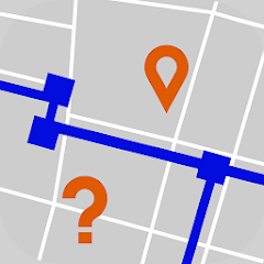
LedningsInfo provides mobile access to the LER system on clay.
LER made easy with LedningsInfo.
LedningsInfo is a client app for the LER system, which gives you a quick overview of wires, cables and pipes directly on the map.
All your LER cases are displayed in the app - users simply open the app and the latest data is displayed.
And much more:
The app displays maps and utilizes your built-in GPS, so the map zooms to your position.
Do a LER search directly in the app and avoid MitID, etc.
See wires, cables and pipes on the map before digging.
Take measurements directly in the app.
The app also shows digging permits and other project-relevant documents.
Upload your own DXF/CAD/GIS data to the system and have them displayed in the app.
Connect an external GPS/rover and place wires precisely in the field.
Register KS on the map with images.
Show terrain elevations by clicking on the map.
See a depth profile showing the depth of the pipes.
Link to owner names etc.
The app is free, but companies must enter into an agreement with GIS4Mobile.
Updated on
Safety starts with understanding how developers collect and share your data. Data privacy and security practices may vary based on your use, region, and age. The developer provided this information and may update it over time.

No data shared with third parties
Learn more about how developers declare sharing

This app may collect these data types
Location, Photos and videos, and Device or other IDs

Data isn’t encrypted
Data can’t be deleted
What’s new
Fixed external GPS(NTRIP client)
Everyone
Learn moreApp support
phone
Phone number
+4540101091
About the developer
Gis4mobile ApS
olh@gis4mobile.com
Solmarksvej 20
C/O Ove Hansen
8240 Risskov
Denmark
+45 40 91 62 23
