
GeoFrame

Everyone
info
5+
Downloads




About this app
The Gontec-MV mobile surveying and documentation app.
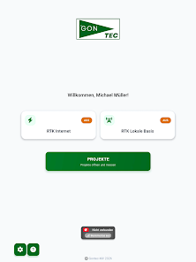
This app is specifically designed for Gontec-MV's devices and workflows. It brings precise surveying, structured documentation, and construction site management directly to your mobile device – for efficient, paperless fieldwork.
Key Features
1. Precise Positioning
High-precision surveying via RTK/NTRIP for centimeter-accurate coordinates directly in the field – individually configured for each device.
2. Capture & Manage Measurements
Quickly and reliably record point and area measurements, organize them clearly, and access them again at any time.
3. Seamless Documentation
Each measurement can be supplemented with additional photos, voice notes, and videos. This ensures that every process is fully and transparently documented.
4. Construction Site Management
Keep track of your construction sites: Structure processes according to manager, construction, and measurement tasks and see the current status at a glance.
5. 3D Visualization
View captured data and models directly in the app as a 3D view – for a better spatial understanding on-site.
6. Reliable Synchronization
Captured data and media are securely synchronized with the Gontec-MV system, ensuring that the office and field staff always have the same information.
Who is the app for?
The app is intended for Gontec-MV employees and users of the associated surveying equipment. Valid Gontec-MV login credentials are required.
Note: This application is designed for professional use with Gontec-MV hardware and software. The functions are not available without the appropriate access.
This app is specifically designed for Gontec-MV's devices and workflows. It brings precise surveying, structured documentation, and construction site management directly to your mobile device – for efficient, paperless fieldwork.
Key Features
1. Precise Positioning
High-precision surveying via RTK/NTRIP for centimeter-accurate coordinates directly in the field – individually configured for each device.
2. Capture & Manage Measurements
Quickly and reliably record point and area measurements, organize them clearly, and access them again at any time.
3. Seamless Documentation
Each measurement can be supplemented with additional photos, voice notes, and videos. This ensures that every process is fully and transparently documented.
4. Construction Site Management
Keep track of your construction sites: Structure processes according to manager, construction, and measurement tasks and see the current status at a glance.
5. 3D Visualization
View captured data and models directly in the app as a 3D view – for a better spatial understanding on-site.
6. Reliable Synchronization
Captured data and media are securely synchronized with the Gontec-MV system, ensuring that the office and field staff always have the same information.
Who is the app for?
The app is intended for Gontec-MV employees and users of the associated surveying equipment. Valid Gontec-MV login credentials are required.
Note: This application is designed for professional use with Gontec-MV hardware and software. The functions are not available without the appropriate access.
Updated on
Safety starts with understanding how developers collect and share your data. Data privacy and security practices may vary based on your use, region, and age. The developer provided this information and may update it over time.


What’s new
Die neue Version der GeoFrame-App.
App support
About the developer
Vitalii Manchenko
bartlomiej.drogos@gontec-mv.de
Vierburgweg 26
18246 Bützow
Germany
+49 176 97744658