

HumberTrail Bolton Map

500+
Downloads

Everyone
info
About this app
The Humber Valley Heritage Trail is a 20 km long pedestrian adventure, which provides a near wilderness experience within easy access of the Greater Toronto Area. It was established by the Humber Valley Heritage Trail Association in the upper reaches of the Humber River in the Town of Caledon, and traverses a vast tract of land managed by the Toronto and Region Conservation Authority.
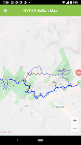
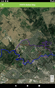
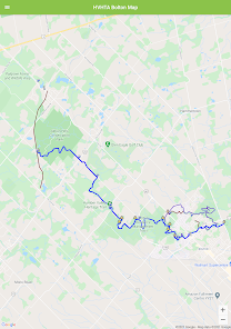
The trail head of the Humber Valley Heritage Trail, kilometre 0, is situated just north of the Albion Hills Conservation area. The trail then crosses through the Conservation Area and follows the winding Humber River Valley south to the historic mill town of Bolton, where full amenities await you.
The valley terrain can be challenging in places and much of the landscape is densely forested. Evidence of wildlife including deer and beaver abound. Look also for magnificent ferns which crowd sections of the trail during the spring and summer months.
Convenient country road trail access points make short and longer walks an option. Detailed trail information and an interactive trail map are available on the Humber Valley Heritage Trail Association web site at www.humbertrail.org
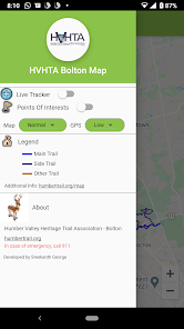
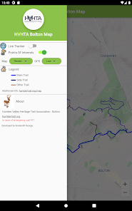
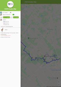
Features:
- Shows your location on the trail
- Illustrates the landscape and vegetation
- Assists in locating convenient road access points
- Links hikers to the TransCanada Trail, the Caledon Rail Trail and the Bruce Trail
The trail head of the Humber Valley Heritage Trail, kilometre 0, is situated just north of the Albion Hills Conservation area. The trail then crosses through the Conservation Area and follows the winding Humber River Valley south to the historic mill town of Bolton, where full amenities await you.
The valley terrain can be challenging in places and much of the landscape is densely forested. Evidence of wildlife including deer and beaver abound. Look also for magnificent ferns which crowd sections of the trail during the spring and summer months.
Convenient country road trail access points make short and longer walks an option. Detailed trail information and an interactive trail map are available on the Humber Valley Heritage Trail Association web site at www.humbertrail.org
Features:
- Shows your location on the trail
- Illustrates the landscape and vegetation
- Assists in locating convenient road access points
- Links hikers to the TransCanada Trail, the Caledon Rail Trail and the Bruce Trail
Updated on
Data safety
Developers can show information here about how their app collects and uses your data. Learn more about data safety

No information available
What's new
Updated latest location plugin