Flyover Country - Inflight GPS
4.5star
726 reviews
100K+
Downloads

Everyone
info


About this app
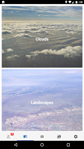
The window is the best kind of in-flight entertainment. Track your flight with GPS - discover the world below with offline maps and POI.
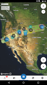
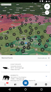
Learn about the world along the path of your flight, hike, or road trip with GPS tracking. Offline geologic maps and interactive points of interest reveal the locations of fossils and georeferenced Wikipedia articles visible from your airplane window seat, road trip, or hiking trail vista.
Follow Flyover Country for updates and photos from the sky!
https://www.facebook.com/flyovercountryapp/
https://twitter.com/flyovergeo
https://www.instagram.com/flyovergeo/
Flyover Country is a National Science Foundation-funded offline mobile app for geoscience outreach and data discovery. The app exposes interactive geologic maps from Macrostrat.org, fossil localities from Neotomadb.org and Paleobiodb.org, Wikipedia articles, offline base maps, and the user’s current GPS determined location, altitude, speed, and heading. The app analyzes a given flight path and caches relevant map data and points of interest (POI), and displays these data during the flight, without in-flight wifi. By downloading only the data relevant to a particular flight path, cache sizes remain reasonable, allowing for a robust experience without an internet connection.
Flyover Country is not limited to the window seat of airplanes. It is also ideal for road trips, hiking, and other outdoor activities such as field trips and geologic fieldwork.
**GPS functionality is only possible from the window seat and GPS reception quality varies by device/conditions**
Updated on
Safety starts with understanding how developers collect and share your data. Data privacy and security practices may vary based on your use, region, and age. The developer provided this information and may update it over time.

No data shared with third parties
Learn more about how developers declare sharing

No data collected
Learn more about how developers declare collection
Ratings and reviews
4.4
682 reviews

A Google user
- Flag inappropriate
- Show review history
November 24, 2018
I use this when driving, hiking, and flying. I love following the geology of an area at such a fine scale, as each hill can have a different origin here in western Oregon. Seeing all the faults is exciting in terms of understanding the topography of the terrain. The developers were very friendly and helpful when I was having issues loading the software in early 2018.
36 people found this review helpful

Steve Gad
- Flag inappropriate
September 8, 2020
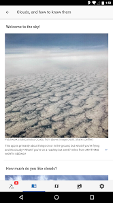
This app was really cool while flying cross country. At first it didnt find my gps but after a couple minutes it located us on the map. It has a lot of really great information on it that you can download for ofline use. I was able to show my kids where we were in our trip and some cool information about what we were flying over. I was even able to read to them about different clouds!
27 people found this review helpful
A Google user
- Flag inappropriate
January 23, 2019
This great when flying. It would be great to have the option to add and remove information from the maps while they are running. Sometimes the info markers obscure the map. It would be good to have more place names. The available information on natural features is great.
18 people found this review helpful
Regents of the University of Minnesota
January 29, 2019
Thanks for the review! You can toggle data layers on and off by pressing the button in the upper right hand corner. Sometimes the markers and place name labels interfere with one another, so toggling layers off can get you more access to place names.
What's new
Hi everyone! We're just updating the targeted android version so more folks can install the app!


