Yorkshire Dales Outdoor Map Pr
100+
Downloads

Everyone
info
About this app
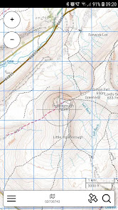
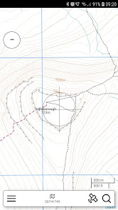
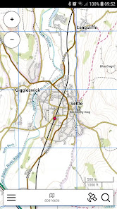
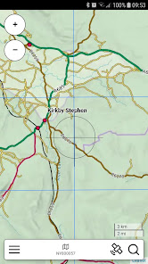
An offline map of the Yorkshire Dales National Park in England, ideal for hiking, running, mountain biking / cycling. Being offline means unlike other map apps, you don't need a signal to access detailed maps of the area.
Features:
* Clearly see footpaths, tracks and contours
* Search for not just towns, but also lakes and hills
* Location in OS grid reference coordinates
* Find your location using your phone GPS
* High zoom level
Features:
* Clearly see footpaths, tracks and contours
* Search for not just towns, but also lakes and hills
* Location in OS grid reference coordinates
* Find your location using your phone GPS
* High zoom level
Updated on
Safety starts with understanding how developers collect and share your data. Data privacy and security practices may vary based on your use, region, and age. The developer provided this information and may update it over time.

No data shared with third parties
Learn more about how developers declare sharing

No data collected
Learn more about how developers declare collection


