
San Andrés 360
Contains ads

Everyone
info
1K+
Downloads

Everyone
Learn more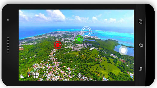

About this app
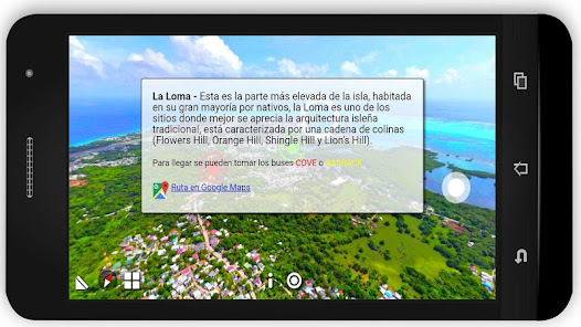
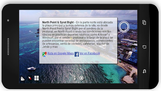
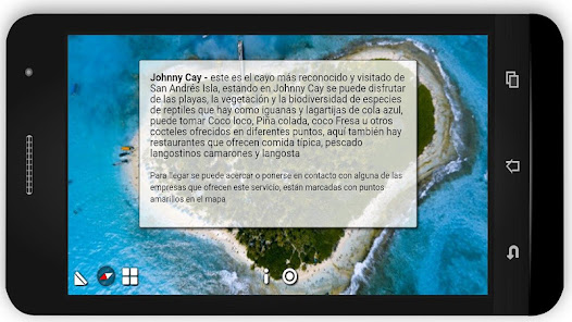
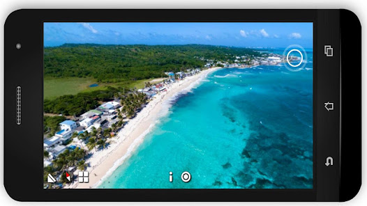
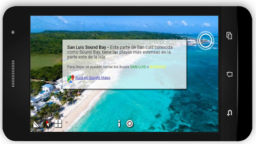
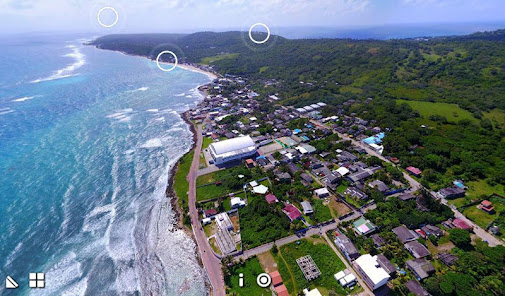
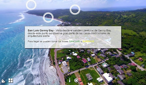
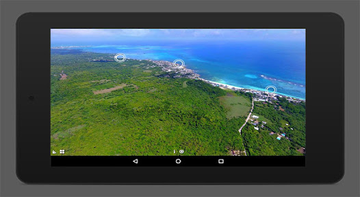
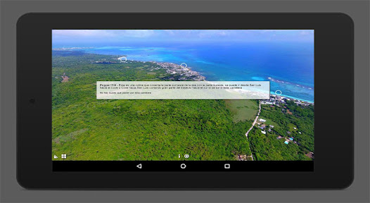
San Andres 360 is an application Guide / Map of San Andres Island, made using 360-degree panoramic aerial photos taken from strategic points to show the whole panorama of each traditional sector of the island, you can find information on each sector, emblematic points and bus routes to get to these.
If you plan to go on vacation to San Andres Island Colombia, having this application installed prior to your arrival gives you the opportunity to know San Andrés in advance, know which are the most visited tourist attractions, how the sectors are connected and how to mobilize using transportation public, all this is possible using panoramic aerial views and landmarks, using these landmarks you can see and understand the relief of the island from north to south and move between sectors and points.
You can navigate in the offline app to be located using only the reference points and recognizing the sector in which it is located or for a more accurate navigation you can use the GPS navigation of Google Maps, in the app you can find a link that will give you Google Maps coordinates to get to the sector that you see on screen, this is also possible to do Offline if you download the map of San Andres in the option of "Maps without Connection" Google Maps
Updated on
Safety starts with understanding how developers collect and share your data. Data privacy and security practices may vary based on your use, region, and age. The developer provided this information and may update it over time.

No data shared with third parties
Learn more about how developers declare sharing

No data collected
Learn more about how developers declare collection
What’s new
-Optimizada para Android 10
-Nuevos Icons
-Nuevos Icons
Everyone
Learn moreApp support
About the developer
Kenny Allen Christopher Abrahams
ken22allen@gmail.com
Colombia