

Leica Cyclone FIELD 360

3.0star
128 reviews
10K+
Downloads

Everyone
info
About this app
Leica Geosystems introduces the Leica Cyclone FIELD 360 app.
As part of the Leica Geosystems Reality Capture Solution, the Leica Cyclone FIELD 360 app links the 3D data acquisition in the field with the RTC360 laser scanner, the BLK360 imaging laser scanner or BLK2GO or BLK2GO PULSE and the data registration with Leica Cyclone REGISTER 360 post-processing office software.
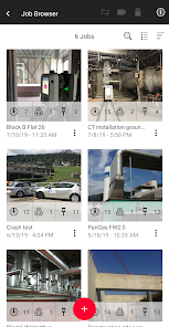
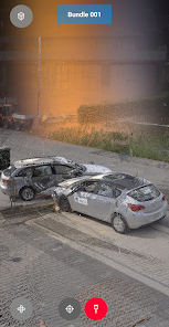
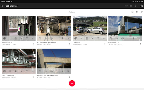
On-site the user can automatically capture, register and examine scan and image data. The user interface combines easy handling of complex calculations with a graphical user guidance which offers a remarkable user experience also for novice users.
VIEW
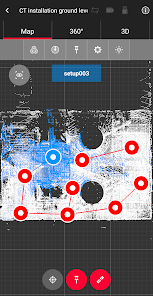
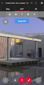
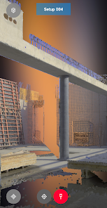
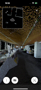
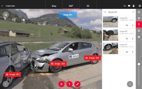
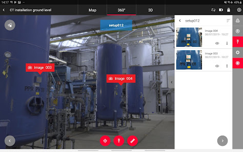
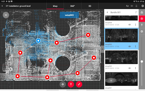
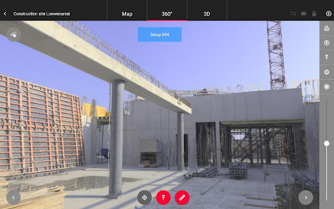
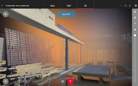
The high-performance Leica Cyclone FIELD 360 mobile-device app is the perfect field companion for the Leica RTC360 3D laser scanner, as well as for the Leica BLK360 imaging laser scanner or BLK2GO or BLK2GO PULSE. Intuitive and instant data visualization with its user interface, remote scanner control and on-site point cloud display, navigation is a breeze - even for novice users – with full imagery and point cloud data delivered directly to a tablet using edge-computing technology.
CHECK
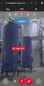
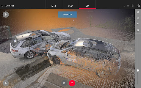
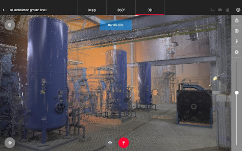
Direct data access and visualisation are the foundation for quality control in the field; with Cyclone FIELD 360, automatically pre-registered point cloud data enables users to quickly conduct on-site quality control checks, improves productivity, and makes for better-informed decisions in the field.
ADD
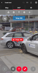
For improved interpretation in Leica Cyclone REGISTER 360 post-processing, and to add extra value and information to 3D data, Cyclone FIELD 360 enables on-site tagging of measurements, videos, images, text or voice files to the point cloud geometry simply by using a tablet.
As part of the Leica Geosystems Reality Capture Solution, the Leica Cyclone FIELD 360 app links the 3D data acquisition in the field with the RTC360 laser scanner, the BLK360 imaging laser scanner or BLK2GO or BLK2GO PULSE and the data registration with Leica Cyclone REGISTER 360 post-processing office software.
On-site the user can automatically capture, register and examine scan and image data. The user interface combines easy handling of complex calculations with a graphical user guidance which offers a remarkable user experience also for novice users.
VIEW
The high-performance Leica Cyclone FIELD 360 mobile-device app is the perfect field companion for the Leica RTC360 3D laser scanner, as well as for the Leica BLK360 imaging laser scanner or BLK2GO or BLK2GO PULSE. Intuitive and instant data visualization with its user interface, remote scanner control and on-site point cloud display, navigation is a breeze - even for novice users – with full imagery and point cloud data delivered directly to a tablet using edge-computing technology.
CHECK
Direct data access and visualisation are the foundation for quality control in the field; with Cyclone FIELD 360, automatically pre-registered point cloud data enables users to quickly conduct on-site quality control checks, improves productivity, and makes for better-informed decisions in the field.
ADD
For improved interpretation in Leica Cyclone REGISTER 360 post-processing, and to add extra value and information to 3D data, Cyclone FIELD 360 enables on-site tagging of measurements, videos, images, text or voice files to the point cloud geometry simply by using a tablet.
Updated on
Safety starts with understanding how developers collect and share your data. Data privacy and security practices may vary based on your use, region and age The developer provided this information and may update it over time.

No data shared with third parties
Learn more about how developers declare sharing

No data collected
Learn more about how developers declare collection
Ratings and reviews
2.0
93 reviews

Maxime K-G
- Flag inappropriate
17 December 2023
You can only use the scanner with a buggy processing software that has the most antiquated access key system out there and will only transmit your data from this app to PC over a crawlingly slow wireless conection with unexpected errors galore. As long as Leica doesn't improved this aspect of the product I would advise to AVOID. There are better alternatives out there which do value customer experience.

Doug Cook
- Flag inappropriate
21 December 2020
3D points are completely missing. Site maps and visual alignment show set-up icons, but no points. This means you can't create links or pre-register on site. What the app does well: - Create and manage jobs - view 360 images of scan positions - scanner control: start/stop and scan settings Where it falls short: - view 3D points for visual align/creating links - Auto-hide/reveal of nav bar. This is unnecessary and causes the app to crash when I try to navigate away from the app
4 people found this review helpful

Antony Mauger
- Flag inappropriate
- Show review history
14 March 2024
Was great. Now purchased a BLK2GO and refuses to connect to Android 14. Connects to apple devices in seconds. Please look into android connectivity. Had similar issues with Gen 1 BLK.
What's new
Support of BLK ARC
- Remote control of the scanner with possibility to launch the Static Scans
Improved upload to Reality Cloud Studio
Re-structured .e57 file to improve handling in BricsCAD
Various bug fixes
- Remote control of the scanner with possibility to launch the Static Scans
Improved upload to Reality Cloud Studio
Re-structured .e57 file to improve handling in BricsCAD
Various bug fixes


