
3D maps (Terrain)

500+
Downloads

Everyone
info

About this app
Topo Maps 3D Maps G_3Dmaps 3D terrain map
This app always knows and uses the current location even when running in the foreground as well as in the background.
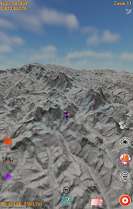
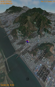
To cover whole world in detail 3D terrain map.
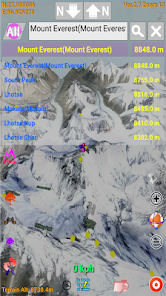
Finding peaks(290,241) of the world
This application covered whole world 3D terrain map based on tile service.
You can use several Open Street Map.
OSM map tiles and elevation data are downloaded only one time.
Downloaded data are utilized as off-line data.
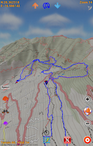
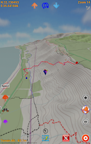
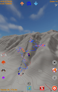
Your outdoor tracking(ski,climbing,running,flight etc.) data is 3D basically.
Save 3D track and Review it.
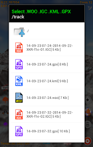
Track saving format WOO,IGC(enable validation),KML,GPX is available.
Import track format also is same.
Enjoy whole world 3D track history.
Elevation data's max resolution is 30m×30m.
This app always knows and uses the current location even when running in the foreground as well as in the background.
To cover whole world in detail 3D terrain map.
Finding peaks(290,241) of the world
This application covered whole world 3D terrain map based on tile service.
You can use several Open Street Map.
OSM map tiles and elevation data are downloaded only one time.
Downloaded data are utilized as off-line data.
Your outdoor tracking(ski,climbing,running,flight etc.) data is 3D basically.
Save 3D track and Review it.
Track saving format WOO,IGC(enable validation),KML,GPX is available.
Import track format also is same.
Enjoy whole world 3D track history.
Elevation data's max resolution is 30m×30m.
Updated on
Safety starts with understanding how developers collect and share your data. Data privacy and security practices may vary based on your use, region, and age. The developer provided this information and may update it over time.

No data shared with third parties
Learn more about how developers declare sharing

No data collected
Learn more about how developers declare collection

Data isn’t encrypted
Data can’t be deleted
What's new
[Version 5.6]
1. Small sound bug fix
1. Small sound bug fix


