Water Net
1K+
Downloads

Everyone
info


About this app
The objectives of this application are
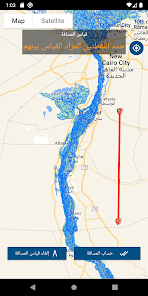
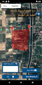
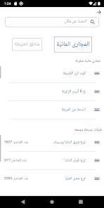
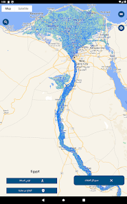
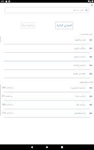
• Assisting users in finding the nearest source of irrigation water and displaying its management information.
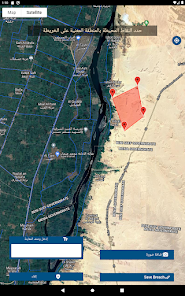
• Show waterway data where the user is standing.
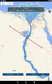
• Determining the location of the kilometer on the watercourse for any specific point
• View geographical coordinates where the user is standing.
• View the background of satellite images or the background of Google Maps its service methods.
• Share coordinates via WhatsApp
In general, this application helps users by showing their locations around the areas of water networks, canals and water sources in order to help them reach the nearest source of water and sewage to them to save every drop of water and avoid road lost and accidents.
• Assisting users in finding the nearest source of irrigation water and displaying its management information.
• Show waterway data where the user is standing.
• Determining the location of the kilometer on the watercourse for any specific point
• View geographical coordinates where the user is standing.
• View the background of satellite images or the background of Google Maps its service methods.
• Share coordinates via WhatsApp
In general, this application helps users by showing their locations around the areas of water networks, canals and water sources in order to help them reach the nearest source of water and sewage to them to save every drop of water and avoid road lost and accidents.
Updated on
Safety starts with understanding how developers collect and share your data. Data privacy and security practices may vary based on your use, region, and age. The developer provided this information and may update it over time.

No data shared with third parties
Learn more about how developers declare sharing

No data collected
Learn more about how developers declare collection
What's new
تم اضافة رسالة انتظار عند التحميل الطويل لتحديد سبب التحميل
App support
phone
Phone number
+201207199086


