
India Satellite Weather
4.6star
31.2 ہزار جائزے
+10 لاکھ
ڈاؤن لوڈز

ہر کوئی
info


اس ایپ کے بارے میں
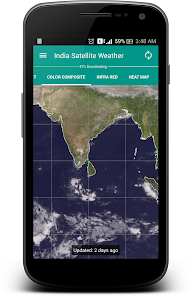
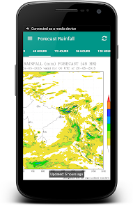
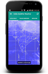
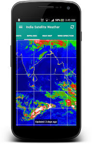
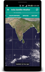
"A picture is worth a thousand words". A complex weather data can be conveyed easily with an image map. By observing the Cloud formations around your City, you can easily predict whether the day is going to be Hot or Rainy/Cloudy.
It is very well equipped with data caching capabilities and will never download duplicate data from the server. The downloaded weather maps will stored locally and can accessed offline.
This application fetches the weather maps directly from Indian Meteorological Department (www.imd.gov.in) and CIMSS [USA] (http://cimss.ssec.wisc.edu)
FYI: I really don't have control on the missing north indian region of some map types because they are provided by USA Meteorological Department.
This is an Open Source Application: https://github.com/Shahul3D/IndiaSatelliteWeather
Feel free to contribute!
اپ ڈیٹ کردہ بتاریخ
ڈیٹا کی حفاظت
ڈویلپرز یہاں اس بارے میں معلومات دکھا سکتے ہیں کہ ان کی ایپ آپ کے ڈیٹا کو کس طرح جمع اور استعمال کرتی ہے۔ ڈیٹا کی حفاظت کے بارے میں مزید جانیں

کوئی معلومات دستیاب نہیں ہے
درجہ بندی اور جائزے
4.6
30.5 ہزار جائزے
نیا کیا ہے
Updated broken MAPs