
SkyRadar


Everyone
info
0+
Downloads

Everyone
Learn more


About this app
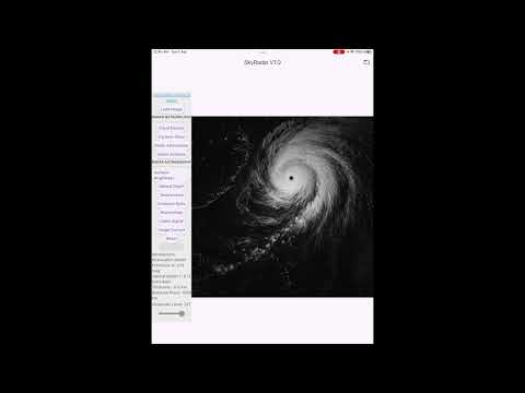
SkyRadar is a scientific image analysis application designed for meteorological radar interpretation and astronomical imaging analysis on Android smartphones and tablets.
The application uses a grayscale-first processing framework based on luminance modelling to analyse satellite, radar, and astrophotography images. By converting RGB data into standardised grayscale intensity values, SkyRadar enables consistent and physically interpretable image analysis across different observational conditions.
🌍 Core Capabilities
SkyRadar provides advanced tools for:
• Cloud structure and density estimation
• Cyclone and storm morphology analysis
• Radar signal attenuation modelling
• Atmospheric reflectivity interpretation
• Surface brightness profiling
• Optical depth estimation
• Celestial image structure analysis
• Emission-based intensity comparison
All processing is performed using pixel-level grayscale computation to improve measurement consistency and reduce colour-based variability.
📡 Radar Meteorology Module
The meteorology section is designed for analysing atmospheric conditions using satellite or radar imagery. It supports:
• Cloud density estimation
• Cyclone classification (convective, stratiform, thin-layer structures)
• Precipitation potential indicators
• Atmospheric attenuation and extinction modelling
• Radar reflectivity analysis
These tools assist in interpreting storm systems and cloud formations using luminance-based physical modelling.
🌌 Astrograph Analysis Module
The astrograph module enables structural analysis of astronomical images, including:
• Surface brightness distribution
• Optical depth estimation
• Emission ratio comparison
• Morphological structure detection
• Stellar and nebula region analysis
• Region-of-interest (ROI) signal interpretation
This allows users to examine celestial structures using consistent grayscale intensity mapping.
⚙️ Image Processing System
SkyRadar uses standard luminance conversion (BT.709 model):
Grayscale = 0.299R + 0.587G + 0.114B
Additional processing includes:
• Brightness normalisation
• Optical attenuation correction
• Pixel variance analysis
• Texture-based structure detection
All calculations are performed locally on the device.
📱 Device Support
SkyRadar is designed for:
• Android smartphones
• Android tablets
The interface adapts to different screen sizes for field and laboratory use.
🔬 Scientific Purpose
SkyRadar is intended for:
• Educational use
• Research exploration
• Meteorological analysis
• Astronomical imaging studies
• Remote sensing interpretation
It provides a unified grayscale analysis framework for atmospheric and astronomical image data.
⚠️ Disclaimer
SkyRadar provides analytical visualisation and image processing tools. All outputs are for informational, educational, and research purposes only and should not be used as a substitute for calibrated meteorological or astronomical instrumentation.
The application uses a grayscale-first processing framework based on luminance modelling to analyse satellite, radar, and astrophotography images. By converting RGB data into standardised grayscale intensity values, SkyRadar enables consistent and physically interpretable image analysis across different observational conditions.
🌍 Core Capabilities
SkyRadar provides advanced tools for:
• Cloud structure and density estimation
• Cyclone and storm morphology analysis
• Radar signal attenuation modelling
• Atmospheric reflectivity interpretation
• Surface brightness profiling
• Optical depth estimation
• Celestial image structure analysis
• Emission-based intensity comparison
All processing is performed using pixel-level grayscale computation to improve measurement consistency and reduce colour-based variability.
📡 Radar Meteorology Module
The meteorology section is designed for analysing atmospheric conditions using satellite or radar imagery. It supports:
• Cloud density estimation
• Cyclone classification (convective, stratiform, thin-layer structures)
• Precipitation potential indicators
• Atmospheric attenuation and extinction modelling
• Radar reflectivity analysis
These tools assist in interpreting storm systems and cloud formations using luminance-based physical modelling.
🌌 Astrograph Analysis Module
The astrograph module enables structural analysis of astronomical images, including:
• Surface brightness distribution
• Optical depth estimation
• Emission ratio comparison
• Morphological structure detection
• Stellar and nebula region analysis
• Region-of-interest (ROI) signal interpretation
This allows users to examine celestial structures using consistent grayscale intensity mapping.
⚙️ Image Processing System
SkyRadar uses standard luminance conversion (BT.709 model):
Grayscale = 0.299R + 0.587G + 0.114B
Additional processing includes:
• Brightness normalisation
• Optical attenuation correction
• Pixel variance analysis
• Texture-based structure detection
All calculations are performed locally on the device.
📱 Device Support
SkyRadar is designed for:
• Android smartphones
• Android tablets
The interface adapts to different screen sizes for field and laboratory use.
🔬 Scientific Purpose
SkyRadar is intended for:
• Educational use
• Research exploration
• Meteorological analysis
• Astronomical imaging studies
• Remote sensing interpretation
It provides a unified grayscale analysis framework for atmospheric and astronomical image data.
⚠️ Disclaimer
SkyRadar provides analytical visualisation and image processing tools. All outputs are for informational, educational, and research purposes only and should not be used as a substitute for calibrated meteorological or astronomical instrumentation.
Grayscale radar and astrograph image analysis for weather and astronomy
Updated on
Safety starts with understanding how developers collect and share your data. Data privacy and security practices may vary based on your use, region, and age. The developer provided this information and may update it over time.
- No data shared with third partiesLearn more about how developers declare sharing
- No data collectedLearn more about how developers declare collection


What’s new
SkyRadar 1.0.0 – Initial Release
• Grayscale-first radar and astrograph analysis engine
• BT.709 luminance-based image standardisation
• Cloud density, cyclone morphology, and radar attenuation tools
• Surface brightness, optical depth, and celestial signal analysis
• Performance and stability optimisations
Everyone
Learn moreApp support
phone
Phone number
+61439591320
About the developer
TELE-OPTIC SERVICES PTY LTD
info@telopt.org
U 204 436 Sandgate Rd
Clayfield QLD 4011
Australia
+61 439 591 320