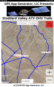
Stoddard Valley ATV OHV Trails
0+
Downloads

Everyone
info


About this app
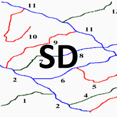
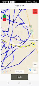
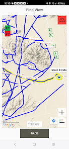
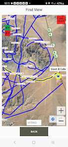
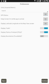
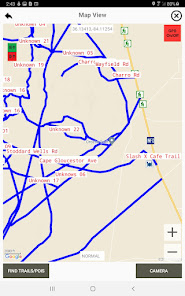
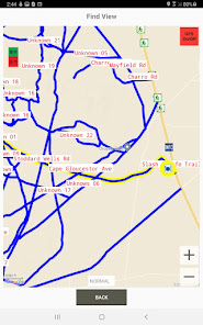
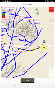
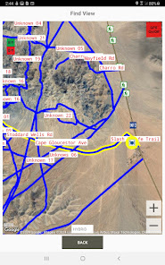
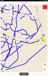
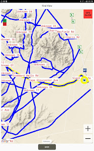
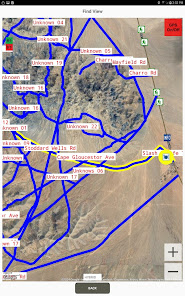
Lifetime Map, no annual subscription fee, no in-app purchases. Located in the Mojave Desert of Southern California, Stoddard Valley OHV Recreation Area offers a diverse landscape for off-highway vehicle recreation. It is characterized by steep rocky mountains, rolling hills, open valleys, and winding sandy washes. Most area visitors ride motorcycles or ATVs, or tour the area in four-wheel drive vehicles.
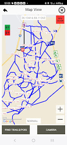
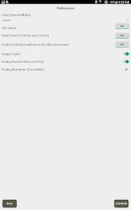
A new option feature is North Up (2D, Default) or Direction of Travel Up (3D, Option), like on a Dashboard GPS. I prefer Direction of Travel Up.
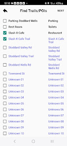
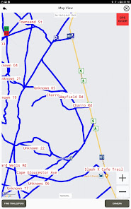
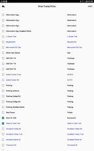
Another improvement is in the List View. The user can select My Location, and a place he wants to go, like a Point of Interest or a Trail, and see it and its relationship to where the User is, on the List View. He can then note the trails in between, return to the List and select My Location, the trails noted, and his destination. Those will be highlighted in Yellow making it easy for the user to navigate to his destination on the List View screen.
A new option feature is North Up (2D, Default) or Direction of Travel Up (3D, Option), like on a Dashboard GPS. I prefer Direction of Travel Up.
Another improvement is in the List View. The user can select My Location, and a place he wants to go, like a Point of Interest or a Trail, and see it and its relationship to where the User is, on the List View. He can then note the trails in between, return to the List and select My Location, the trails noted, and his destination. Those will be highlighted in Yellow making it easy for the user to navigate to his destination on the List View screen.
Updated on
Safety starts with understanding how developers collect and share your data. Data privacy and security practices may vary based on your use, region, and age. The developer provided this information and may update it over time.

No data shared with third parties
Learn more about how developers declare sharing

No data collected
Learn more about how developers declare collection


