

QH sử dụng đất Bến Tre
Contains ads

5K+
Downloads

Everyone
info
About this app
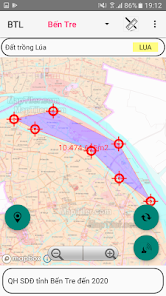
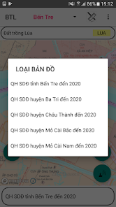
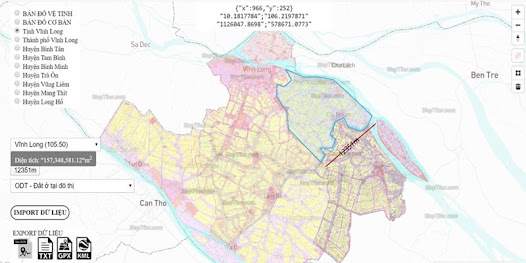
- Support to look up plans, land use planning in Ben Tre province
- Using Mapbox.com's basemap technology on published land use plans
- Determine the user's current location on the land use planning map
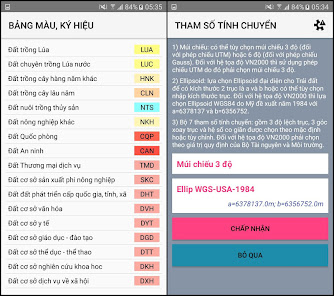
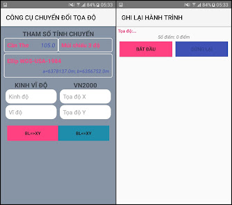
- Use 02 coordinate systems Longitude, Latitude and coordinate system VN2000
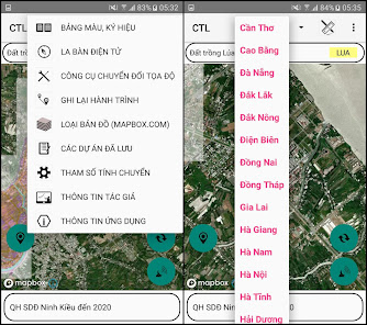
- Support map zoom function, rotate Map in North-South axis
- Electronic compass (only supports devices with magnetic induction chip)
- Support for customizing transfer calculation parameters
- Save and Display points, areas by Object, Project
- Change color, hide and show objects and points in the Project
- Save the free drawn area
- View, Edit, Delete, Find Landmarks
- Function to navigate to objects, save points
- Support the function to redraw survey route over time
- Support function to display map styles from mapbox.com
- Draw Points, Polygon Domains; Measure Distance, calculate Area
- Export point data into .kml .gpx . file types
- Support import point data from .gpx . file
- Send and exchange data of save points
- Supports conversion tools between coordinate systems
- Using Mapbox.com's basemap technology on published land use plans
- Determine the user's current location on the land use planning map
- Use 02 coordinate systems Longitude, Latitude and coordinate system VN2000
- Support map zoom function, rotate Map in North-South axis
- Electronic compass (only supports devices with magnetic induction chip)
- Support for customizing transfer calculation parameters
- Save and Display points, areas by Object, Project
- Change color, hide and show objects and points in the Project
- Save the free drawn area
- View, Edit, Delete, Find Landmarks
- Function to navigate to objects, save points
- Support the function to redraw survey route over time
- Support function to display map styles from mapbox.com
- Draw Points, Polygon Domains; Measure Distance, calculate Area
- Export point data into .kml .gpx . file types
- Support import point data from .gpx . file
- Send and exchange data of save points
- Supports conversion tools between coordinate systems
Updated on
Safety starts with understanding how developers collect and share your data. Data privacy and security practices may vary based on your use, region, and age. The developer provided this information and may update it over time.

No data shared with third parties
Learn more about how developers declare sharing

No data collected
Learn more about how developers declare collection

Data is encrypted in transit


