NCTE-Inspection GIS

Everyone
info
Government
info
5K+
Downloads

Everyone
Learn more


About this app
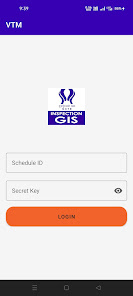
NCTE Inspection GIS is an official application designed to support inspection and monitoring activities for educational institutions.
The app enables authorized users to collect, manage, and submit GIS-based inspection data efficiently.
Key Features:
• Capture location-based data using GPS
• Upload inspection photos and details
• Real-time data synchronization
• Easy reporting and monitoring
This application is intended for official use by authorized personnel only.
Updated on
Safety starts with understanding how developers collect and share your data. Data privacy and security practices may vary based on your use, region, and age. The developer provided this information and may update it over time.

No data shared with third parties
Learn more about how developers declare sharing

No data collected
Learn more about how developers declare collection
Everyone
Learn moreApp support
About the developer
National Council for Teacher Education
mail@ncte-india.org
G-7, Sector10, Dwarka
Delhi, 110075
India
+91 91190 21695