
Povodňový portál Lbc kraje
100+
Downloads

Everyone
info


About this app
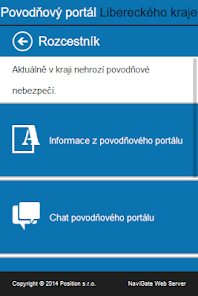
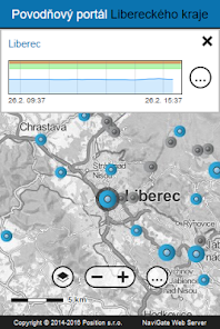
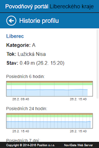
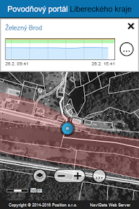
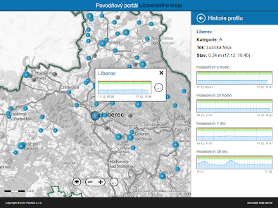
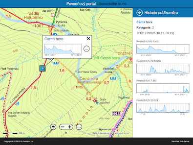
Liberec region, department of Environment and Agriculture, prepared this mobile application to help flood protection in the region. The application provides information on current water levels in rivers and current clashes in the district. It contains data from the watchers profile category A, B and C, and data from rain gauges categories 1 and 2. Shows the history of water levels and precipitation in the form of graphs.
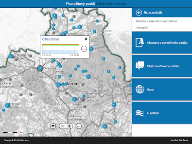
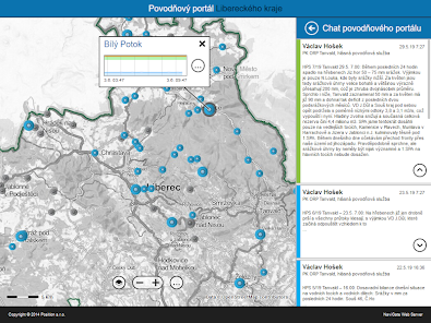
It also displays the current flood status information from the portal and flood chat Flood Commission. The application also includes support for the regime of exercise.
The condition for full functionality of the application is a data connection.
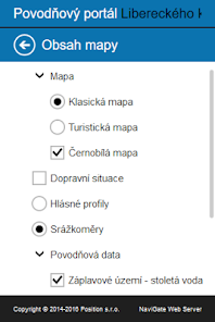
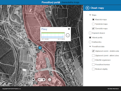
The application also allows you to:
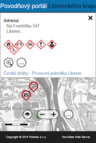
- searching for addresses and parcel numbers in the region,
- display the current traffic situation in the region,
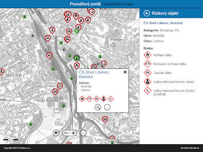
- display additional information layers of the Geoportal Liberec Region (floodplains, flood commissions, risk objects, etc.).
Current data also are displayed in the desktop web application at:
http://geoportal.kraj-lbc.cz/povodnova-mapa
It also displays the current flood status information from the portal and flood chat Flood Commission. The application also includes support for the regime of exercise.
The condition for full functionality of the application is a data connection.
The application also allows you to:
- searching for addresses and parcel numbers in the region,
- display the current traffic situation in the region,
- display additional information layers of the Geoportal Liberec Region (floodplains, flood commissions, risk objects, etc.).
Current data also are displayed in the desktop web application at:
http://geoportal.kraj-lbc.cz/povodnova-mapa
Updated on
Safety starts with understanding how developers collect and share your data. Data privacy and security practices may vary based on your use, region, and age. The developer provided this information and may update it over time.

No data shared with third parties
Learn more about how developers declare sharing

No data collected
Learn more about how developers declare collection
What's new
Aktualizace kontaktů v aplikaci.