
NWA App
Contains adsIn-app purchases

10K+
Downloads

Everyone
info


About this app
App for the anglers of the Lower Saxony-Westphalian Anglers' Association e. v.
*** NEW 2024 - Use Google Maps for navigation ***
This app does not come from NWA e.V. but is a privately made app for NWA e.V. anglers.
This includes:
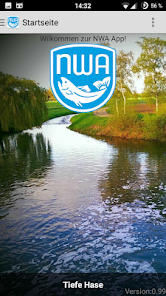
1. Home page with 130 images of the NWA waters.
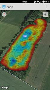
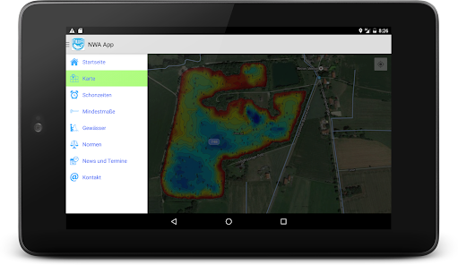
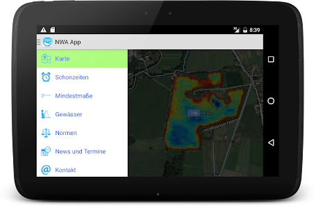
2. Water maps (Google Maps) with all NWA waters and direct navigation options. The depth maps and restricted routes are built directly into the Google Map.
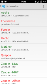
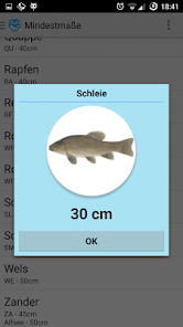
3. Closed periods and minimum dimensions of the NWA.
4. List of all NWA waters.
5. NWA standards.
6. News and dates.
7. Contact page.
I would be happy to accept any suggestions or suggestions for improvement.
*** NEW 2024 - Use Google Maps for navigation ***
This app does not come from NWA e.V. but is a privately made app for NWA e.V. anglers.
This includes:
1. Home page with 130 images of the NWA waters.
2. Water maps (Google Maps) with all NWA waters and direct navigation options. The depth maps and restricted routes are built directly into the Google Map.
3. Closed periods and minimum dimensions of the NWA.
4. List of all NWA waters.
5. NWA standards.
6. News and dates.
7. Contact page.
I would be happy to accept any suggestions or suggestions for improvement.
Updated on
Safety starts with understanding how developers collect and share your data. Data privacy and security practices may vary based on your use, region and age The developer provided this information and may update it over time.

No data shared with third parties
Learn more about how developers declare sharing

No data collected
Learn more about how developers declare collection

Data is encrypted in transit

Data can’t be deleted
What's new
Newsbereich bearbeitet.
App support
phone
Phone number
+4959719628130