
Rhodes offline map
100+
Downloads

Everyone
info
About this app
Offline map of the Greek island of Rhodes for tourist and business visitors. Download the app before you go or using your hotel's Wi-Fi and avoid expensive roaming charges. The map runs completely on your device; map display with pan and infinite zoom, routing, searching, everything. It does not use your data connection at all. Switch your phone function off if you want to!
Is it all in Greek? No. We have made the map in Greek and "English". Bilingual information from the original map data is used where available and, in a few cases, we have filled in with our automatic transliteration technology. The Find and Gazetteer functions uses "English". Relax and enjoy!
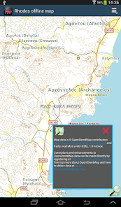
The map is based on OpenStreetMap data, http://www.openstreetmap.org.
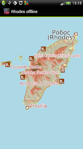
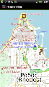
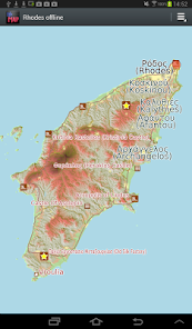
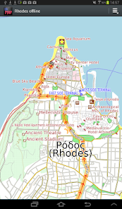
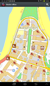
What is good in Rhodes: Places (towns, villages), the airport, roads, things to do and see appear very well mapped. Coverage of Rhodes city hotels and tourist eating places are reasonably well covered.
What is not so good: Most roads lack names. Many amenities like doctors and banks are mostly missing. Resort hotels outside the city are only partially mapped. Mapping of forest cover is very inaccurate. You can help improve it by becoming an OpenStreetMap contributor. We will publish app updates with new information.
Terrain is shown on the map, and can be turned on or off.
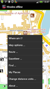
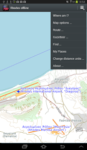
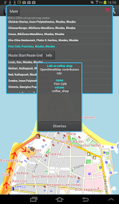
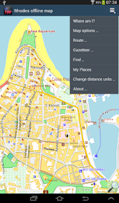
You can:
* find out where you are, if you have GPS.
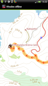
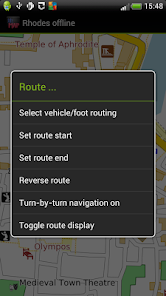
* show a route between any place for motor vehicle, foot or bicycle; even without a GPS device.
* display simple turn-by-turn navigation [*].
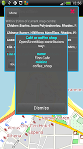
* search for places
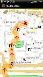
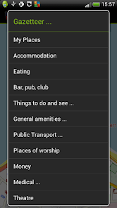
* display gazetteer lists of commonly needed places like hotels, eating places, shops, banks, things to see and do, golf courses, medical facilities. Show how to get there from your current location.
* bookmark places like your hotel for easy return navigation.
* * Navigation will show you an indicative route and can be configured for car, bicycle or foot. The developers provide it without any guarantee that it is always correct. For example, OpenStreetMap data does not always have turn restrictions - places where it is illegal to turn. Use with care and above all look out for and obey road signs.
We hope it does not happen to you but: Like most small developers, we cannot test a wide variety of phones and tablets. If you have trouble running the application, do email us and we will try to help and/or refund you.
Is it all in Greek? No. We have made the map in Greek and "English". Bilingual information from the original map data is used where available and, in a few cases, we have filled in with our automatic transliteration technology. The Find and Gazetteer functions uses "English". Relax and enjoy!
The map is based on OpenStreetMap data, http://www.openstreetmap.org.
What is good in Rhodes: Places (towns, villages), the airport, roads, things to do and see appear very well mapped. Coverage of Rhodes city hotels and tourist eating places are reasonably well covered.
What is not so good: Most roads lack names. Many amenities like doctors and banks are mostly missing. Resort hotels outside the city are only partially mapped. Mapping of forest cover is very inaccurate. You can help improve it by becoming an OpenStreetMap contributor. We will publish app updates with new information.
Terrain is shown on the map, and can be turned on or off.
You can:
* find out where you are, if you have GPS.
* show a route between any place for motor vehicle, foot or bicycle; even without a GPS device.
* display simple turn-by-turn navigation [*].
* search for places
* display gazetteer lists of commonly needed places like hotels, eating places, shops, banks, things to see and do, golf courses, medical facilities. Show how to get there from your current location.
* bookmark places like your hotel for easy return navigation.
* * Navigation will show you an indicative route and can be configured for car, bicycle or foot. The developers provide it without any guarantee that it is always correct. For example, OpenStreetMap data does not always have turn restrictions - places where it is illegal to turn. Use with care and above all look out for and obey road signs.
We hope it does not happen to you but: Like most small developers, we cannot test a wide variety of phones and tablets. If you have trouble running the application, do email us and we will try to help and/or refund you.
Updated on
Safety starts with understanding how developers collect and share your data. Data privacy and security practices may vary based on your use, region, and age. The developer provided this information and may update it over time.

No data shared with third parties
Learn more about how developers declare sharing

This app may collect these data types
App activity, App info and performance, and Device or other IDs

Data is encrypted in transit

Data can’t be deleted
What's new
- Latest OpenStreetMap data
- Android 10 compatibility
- Removed "Advanced Find" menu item to simplify the app, contact us via our Developer Email on the Google Play Store if you want this back.
- Added Crashlytics. If the app crashes, information about the crash is automatically sent to us. No personal data is sent. Your location is not sent.
- Ski runs and ski lifts now show where applicable
- Reservoir dams now show
- Some map style tweaks, e.g service roads thinner to contrast them better.


