
Fly3D
1K+
Downloads

Everyone
info


About this app
The first full 3D moving map to VFR pilots:
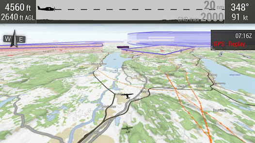
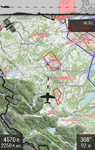
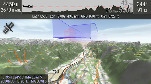
Flowing 2D and 3D representation of
* landscapes
* Airspaces
* Routes (planning intuitively with elevation and 3D window display)
* Tracks (gpx format)
* Airports with traffic patterns (currently about 350 square rounds in Germany)
current map for D / A / CH
Extensions for other countries + more features in the works ..
The app needs access to Fly3D infrastructure. Details on http://fly3d-app.com
Updated on
Safety starts with understanding how developers collect and share your data. Data privacy and security practices may vary based on your use, region and age The developer provided this information and may update it over time.

No data shared with third parties
Learn more about how developers declare sharing

This app may collect these data types
Personal info

Data is encrypted in transit