
ImmoRisk - Risques & prix immo
In-app purchases


Everyone
info
500+
Downloads


About this app
Before a viewing, before making an offer, before signing: take a few seconds to analyze the address.
ImmoRisk compiles in a clear fact sheet everything a buyer needs to know about a property in France: natural and technological risks, surrounding nuisances, the actual market price in the area, and an estimate of the room for negotiation. All based on official public data, with no account required and no advertising.
WHAT THE APP DOES
Address Risk Scan
More than twenty natural and technological risks: flooding, rising groundwater, coastal erosion, seismic activity, landslides, clay soils, forest fires, radon, classified facilities for environmental protection (ICPE) and Seveso sites, and cavities. For each risk, a fact sheet explains the phenomenon, its financial impact, points to check on-site, and arguments to use with the seller. History of natural disaster declarations for the municipality.
Nuisances and Environment
Zoning in the Local Urban Development Plan (PLU), cell towers, aircraft and ground noise, contaminated sites and soils, high-voltage power lines, wind turbines – and, in beta, the neighborhood of the address: noise sources (bars, schools, community centers, sports facilities, etc.) and odor nuisances (livestock farms, waste disposal sites, industrial sites, etc.), with names and distances.
Area Prices
Average price per square meter calculated over five years of notarial transactions (DVF), scale from low to high of the local market, filters for houses or apartments, adjustable radius, recent sales on a map.
Negotiation Simulator
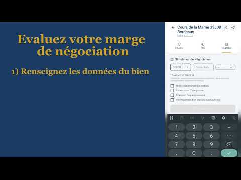
Based on the advertised price, surface area, and Energy Performance Certificate (EPC) rating, the app estimates a negotiation margin using three levers: premium compared to the market, impact of the EPC, and costs related to risks. You select the work to be done, adjust it with your quotes, and get a ready-to-share offer.
Complete PDF Report
A two-part report: one part to prepare your purchase, the other to present to the seller or agent.
PUBLIC AND OFFICIAL DATA
ImmoRisk is independent: it does not represent any government entity and is neither affiliated with nor endorsed by the administrations whose data it consults. Sources:
Georisks: https://www.georisques.gouv.fr
National Address Database: https://adresse.data.gouv.fr
DVF Sales: https://explore.data.gouv.fr/immobilier
Urban Planning Geoportal: https://www.geoportail-urbanisme.gouv.fr
ANFR Antennas: https://data.anfr.fr
IGN Geoplatform: https://geoservices.ign.fr
OpenStreetMap (neighborhood): © contributors, ODbL license
ImmoRisk public data extracts (DVF prices): data.immorisk.fr
Requests originate from your device and are sent to these services and our public data extracts without requiring an account, login, or opaque proprietary scoring.
NO ACCOUNT, NO ADS, NO TRACKER
No registration, no email, no password. No advertising trackers, no audience measurement. Your searches remain on your device.
USAGE
The first three analyses are free: risks, nuisances, prices, and margin estimates are displayed. The detailed analysis (neighbor names and distances, mapping, quantified levers, complete rationale, rights and recourse, PDF report) requires a package: 1 analysis (€1.49), 5 (€3.99), 20 (€9.99), or 75 (€29.99). No subscription required. An unlocked email address is all you need.
IMPORTANT INFORMATION
Coverage: Metropolitan France and French overseas departments and territories, except for DVF prices in Alsace-Moselle and Mayotte (not published by the administration). Estimates are indicative only: they are not professional opinions, expert assessments, or financial advice; they do not replace a risk assessment (ERP). Neighborhood data, sourced from collaborative databases, should be verified on-site. A login is required for a new analysis. Addresses that have already been analyzed remain accessible offline for 30 days.
ImmoRisk compiles in a clear fact sheet everything a buyer needs to know about a property in France: natural and technological risks, surrounding nuisances, the actual market price in the area, and an estimate of the room for negotiation. All based on official public data, with no account required and no advertising.
WHAT THE APP DOES
Address Risk Scan
More than twenty natural and technological risks: flooding, rising groundwater, coastal erosion, seismic activity, landslides, clay soils, forest fires, radon, classified facilities for environmental protection (ICPE) and Seveso sites, and cavities. For each risk, a fact sheet explains the phenomenon, its financial impact, points to check on-site, and arguments to use with the seller. History of natural disaster declarations for the municipality.
Nuisances and Environment
Zoning in the Local Urban Development Plan (PLU), cell towers, aircraft and ground noise, contaminated sites and soils, high-voltage power lines, wind turbines – and, in beta, the neighborhood of the address: noise sources (bars, schools, community centers, sports facilities, etc.) and odor nuisances (livestock farms, waste disposal sites, industrial sites, etc.), with names and distances.
Area Prices
Average price per square meter calculated over five years of notarial transactions (DVF), scale from low to high of the local market, filters for houses or apartments, adjustable radius, recent sales on a map.
Negotiation Simulator
Based on the advertised price, surface area, and Energy Performance Certificate (EPC) rating, the app estimates a negotiation margin using three levers: premium compared to the market, impact of the EPC, and costs related to risks. You select the work to be done, adjust it with your quotes, and get a ready-to-share offer.
Complete PDF Report
A two-part report: one part to prepare your purchase, the other to present to the seller or agent.
PUBLIC AND OFFICIAL DATA
ImmoRisk is independent: it does not represent any government entity and is neither affiliated with nor endorsed by the administrations whose data it consults. Sources:
Georisks: https://www.georisques.gouv.fr
National Address Database: https://adresse.data.gouv.fr
DVF Sales: https://explore.data.gouv.fr/immobilier
Urban Planning Geoportal: https://www.geoportail-urbanisme.gouv.fr
ANFR Antennas: https://data.anfr.fr
IGN Geoplatform: https://geoservices.ign.fr
OpenStreetMap (neighborhood): © contributors, ODbL license
ImmoRisk public data extracts (DVF prices): data.immorisk.fr
Requests originate from your device and are sent to these services and our public data extracts without requiring an account, login, or opaque proprietary scoring.
NO ACCOUNT, NO ADS, NO TRACKER
No registration, no email, no password. No advertising trackers, no audience measurement. Your searches remain on your device.
USAGE
The first three analyses are free: risks, nuisances, prices, and margin estimates are displayed. The detailed analysis (neighbor names and distances, mapping, quantified levers, complete rationale, rights and recourse, PDF report) requires a package: 1 analysis (€1.49), 5 (€3.99), 20 (€9.99), or 75 (€29.99). No subscription required. An unlocked email address is all you need.
IMPORTANT INFORMATION
Coverage: Metropolitan France and French overseas departments and territories, except for DVF prices in Alsace-Moselle and Mayotte (not published by the administration). Estimates are indicative only: they are not professional opinions, expert assessments, or financial advice; they do not replace a risk assessment (ERP). Neighborhood data, sourced from collaborative databases, should be verified on-site. A login is required for a new analysis. Addresses that have already been analyzed remain accessible offline for 30 days.
Real estate: risks, nuisances, DVF prices and negotiation margin. No accounting required.
Updated on
Safety starts with understanding how developers collect and share your data. Data privacy and security practices may vary based on your use, region, and age. The developer provided this information and may update it over time.
- No data shared with third partiesLearn more about how developers declare sharing
- No data collectedLearn more about how developers declare collection
- Data is encrypted in transit
- Data can’t be deleted


What’s new
ImmoRisk évolue chaque semaine !
Nouveau - Analyse du voisinage (bêta) : sources de bruit (bars, écoles, équipements sportifs…) et nuisances olfactives (élevages, déchetteries, sites industriels…), avec détails pour les adresses débloquées.
Plus rapide, robuste : les prix du quartier (DVF) sont servis par nos propres serveurs, et les données consultées sont conservées 30 jours sur votre appareil - les adresses revisitées s'affichent instantanément, même hors connexion. Ajout Pack à 1,49 euros.
Nouveau - Analyse du voisinage (bêta) : sources de bruit (bars, écoles, équipements sportifs…) et nuisances olfactives (élevages, déchetteries, sites industriels…), avec détails pour les adresses débloquées.
Plus rapide, robuste : les prix du quartier (DVF) sont servis par nos propres serveurs, et les données consultées sont conservées 30 jours sur votre appareil - les adresses revisitées s'affichent instantanément, même hors connexion. Ajout Pack à 1,49 euros.
App support
phone
Phone number
+33556983773
About the developer
CANO FLORIAN
contact@immorisk.fr
8 IMPASSE DE LA MAISONNERAIE DU STADE
33320 LE TAILLAN-MEDOC
France
+33 5 56 98 37 73