
D-Space
Contains adsIn-app purchases
5K+
Downloads

Everyone
info


About this app
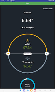
It is the first entirely Italian app that helps the SAPR pilot or the simple drone enthusiast to understand where he can fly and what kind of permissions are needed to do so.
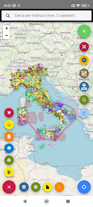
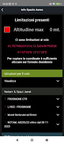
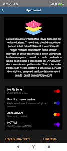
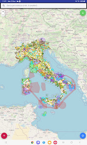
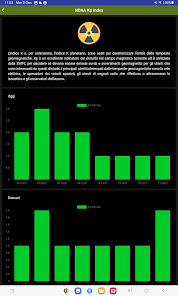
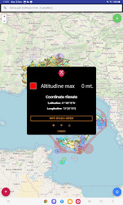
The app is equipped with a continuously updated map that shows a series of information layers, from the classic CTRs, take-off and landing corridors, to NO FLY ZONES, to monthly NOTAMs issued updated in real time.
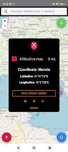
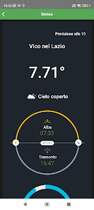
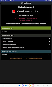
The operation is very simple, the user chooses a point where to fly and the system automatically provides all the information necessary to do so.
The data is updated continuously based on the changes in both the regulation and the actual maps and centralizes in the documents section most of the instruments necessary in order to perform a flight in total safety.
The app is equipped with a continuously updated map that shows a series of information layers, from the classic CTRs, take-off and landing corridors, to NO FLY ZONES, to monthly NOTAMs issued updated in real time.
The operation is very simple, the user chooses a point where to fly and the system automatically provides all the information necessary to do so.
The data is updated continuously based on the changes in both the regulation and the actual maps and centralizes in the documents section most of the instruments necessary in order to perform a flight in total safety.
Updated on
Safety starts with understanding how developers collect and share your data. Data privacy and security practices may vary based on your use, region and age The developer provided this information and may update it over time.

This app may share these data types with third parties
Location

No data collected
Learn more about how developers declare collection

Data is encrypted in transit

Data can’t be deleted
What's new
Bug fixings;
Screen Rotation;
Documents update;
Screen Rotation;
Documents update;