
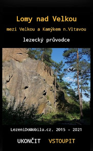
Lomy nad Velkou
5+
Downloads

Everyone
info


About this app
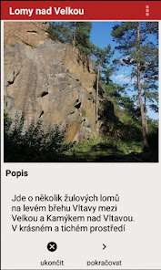
The Lomy nad Velkou climbing guide maps a group of granite quarries on the left bank of the Vltava between the villages of Velká and Kamýk nad Vltavou.
Issue of 12.11.2021. The wizard is usable from Android 4.0.1, it is compiled for Android 11.
All data is stored in the phone's memory, the application does not require internet access.
The application is downloaded to external storage, to the SD card. If the SD card is not in the phone, it will be downloaded to the internal storage.
Another guide at www.lezenidomobilu.cz.
The Lomy nad Vltavou guide includes:
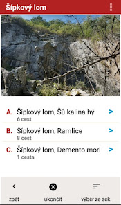
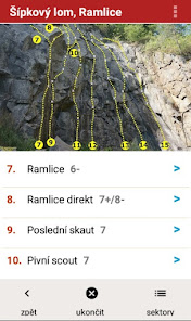
- photographic tops of sectors with drawn road lines, marked with security,
detailed description (difficulty, length, number of safeguards, description of climbing)
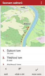
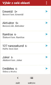
- a map of the area with marked sectors and the possibility of navigating according to the distance to the landmarks marked on the map
- description of individual sectors
- graphical control menu (icons) and corresponding text menu
is equipped with the following functions:
- selection of routes according to difficulty, both in the whole area and in individual sectors
- the possibility of recording the climb with the indication of the style (AF, RP, PP, FLASH, OS) and notes, or just notes on the route and the date of the record
- deleting records of climbed routes
- listing of all climbed paths (paths with note)
- maps of access to individual rock sectors
- end (switch off) the wizard
Issue of 12.11.2021. The wizard is usable from Android 4.0.1, it is compiled for Android 11.
All data is stored in the phone's memory, the application does not require internet access.
The application is downloaded to external storage, to the SD card. If the SD card is not in the phone, it will be downloaded to the internal storage.
Another guide at www.lezenidomobilu.cz.
The Lomy nad Vltavou guide includes:
- photographic tops of sectors with drawn road lines, marked with security,
detailed description (difficulty, length, number of safeguards, description of climbing)
- a map of the area with marked sectors and the possibility of navigating according to the distance to the landmarks marked on the map
- description of individual sectors
- graphical control menu (icons) and corresponding text menu
is equipped with the following functions:
- selection of routes according to difficulty, both in the whole area and in individual sectors
- the possibility of recording the climb with the indication of the style (AF, RP, PP, FLASH, OS) and notes, or just notes on the route and the date of the record
- deleting records of climbed routes
- listing of all climbed paths (paths with note)
- maps of access to individual rock sectors
- end (switch off) the wizard
Updated on
Safety starts with understanding how developers collect and share your data. Data privacy and security practices may vary based on your use, region, and age. The developer provided this information and may update it over time.

No data shared with third parties
Learn more about how developers declare sharing

No data collected
Learn more about how developers declare collection
What's new
Lezecký průvodce Lomy nad Velkou mapuje skupinu žulových lomů na levém břehu Vltavy mezi obcí Velká a Kamýkem nad Vltavou.
Vydání z 12.11.2021. Průvodce je použitelný od verze Android 4.0.1, je kompilován pro verzi Android 11.
Všechna data jsou uložena v paměti telefonu, aplikace nevyžaduje přístup na internet.
Vydání z 12.11.2021. Průvodce je použitelný od verze Android 4.0.1, je kompilován pro verzi Android 11.
Všechna data jsou uložena v paměti telefonu, aplikace nevyžaduje přístup na internet.