Aluskartta
Contains ads
10K+
Downloads

Everyone
info

About this app
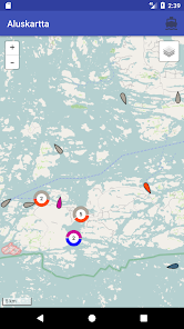
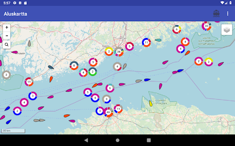
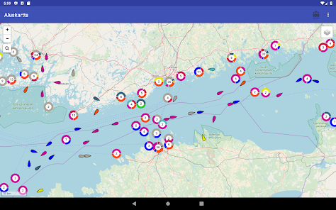
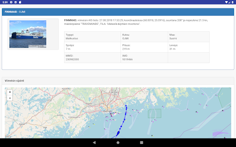
With the Map Map application, you can track the AIS real-time data on the map base of the Finnish Transport Agency, and ship information and location information will automatically be updated on the map. Different types of vessels are marked with different color codes, and the nearby vessels are grouped together to ensure performance.
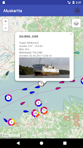
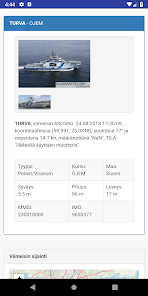
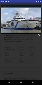
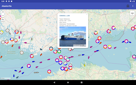
Click on the vessel's name to see more information about the vessel.
AIS data: Creative Commons 4.0 Traffic Bureau. Not for navigation use, does not meet the requirements of the official chart chart.
Click on the vessel's name to see more information about the vessel.
AIS data: Creative Commons 4.0 Traffic Bureau. Not for navigation use, does not meet the requirements of the official chart chart.
Updated on
Safety starts with understanding how developers collect and share your data. Data privacy and security practices may vary based on your use, region, and age. The developer provided this information and may update it over time.

No data shared with third parties
Learn more about how developers declare sharing

No data collected
Learn more about how developers declare collection
What's new
Aluksen nimeä klikkaamalla, saa aluksesta lisää tietoja.
Info -valikossa näkyy tietoa mahdollisista häiriöistä ja käyttökatkoksista.
Info -valikossa näkyy tietoa mahdollisista häiriöistä ja käyttökatkoksista.