10K+
Downloads

Everyone
info
About this app
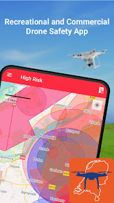
The GoDrone app, provided by LVNL and Altitude Angel in partnership, supports recreational drone flying by letting you know where and how you can fly your drone.
Please note that GoDrone app only provides airspace information for the Netherlands.
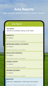
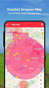
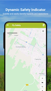
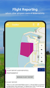
GoDrone provides location-based information on areas of airspace to avoid or in which extreme caution should be exercised, as well as on ground hazards that may pose safety, security or privacy risks.
This app will help you to abide by those rules, providing a tool to assist you in enjoying flying your drone whilst protecting your safety and the safety of other airspace users.
Features
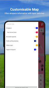
View areas of controlled airspace, such as airfields and airports, where flying a drone could be hazardous or prohibited.
View ground hazards, such as schools, overhead power lines and sports venues, flying close to which may raise security, privacy or safety concerns and could breach NL rules on drone flying.
Please note that GoDrone app only provides airspace information for the Netherlands.
GoDrone provides location-based information on areas of airspace to avoid or in which extreme caution should be exercised, as well as on ground hazards that may pose safety, security or privacy risks.
This app will help you to abide by those rules, providing a tool to assist you in enjoying flying your drone whilst protecting your safety and the safety of other airspace users.
Features
View areas of controlled airspace, such as airfields and airports, where flying a drone could be hazardous or prohibited.
View ground hazards, such as schools, overhead power lines and sports venues, flying close to which may raise security, privacy or safety concerns and could breach NL rules on drone flying.
Updated on
Safety starts with understanding how developers collect and share your data. Data privacy and security practices may vary based on your use, region, and age. The developer provided this information and may update it over time.


What's new
• Improved registration, login and MFA setup user experience.
• Improved date & time formatting within SMS messages
• Improved rendering of circular features (e.g. Areas of Increased Risk, TFRs and Missions)
• Mission Plans have a reduced opacity on the map
• 'Control Zone (CTR)' is now listed under the basic map filters, not advanced
• Improved date & time formatting within SMS messages
• Improved rendering of circular features (e.g. Areas of Increased Risk, TFRs and Missions)
• Mission Plans have a reduced opacity on the map
• 'Control Zone (CTR)' is now listed under the basic map filters, not advanced